
MyTopo
Bloom Creek Montana US Topo Map
Couldn't load pickup availability
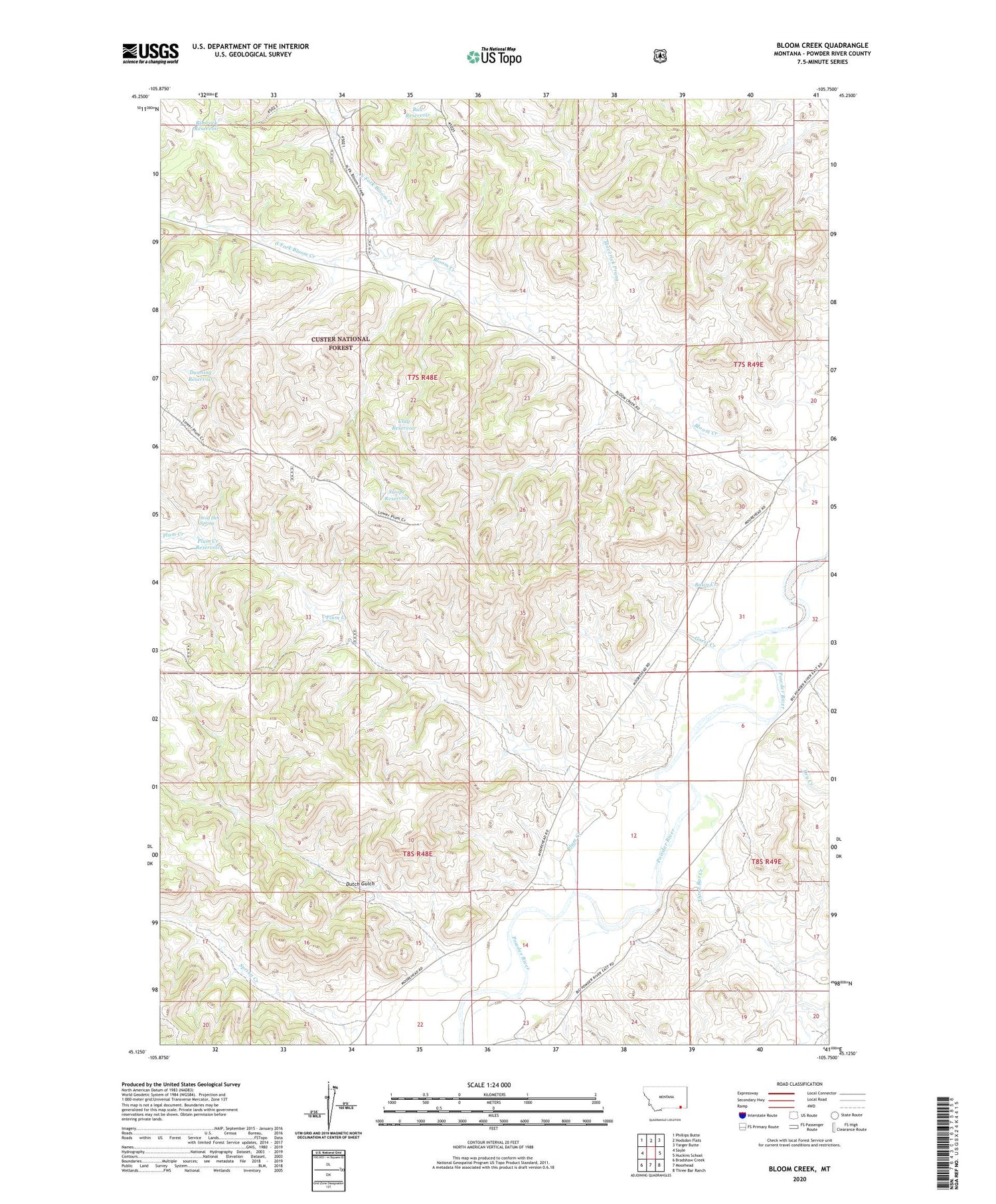
2020 topographic map quadrangle Bloom Creek in the state of Montana. Scale: 1:24000. Based on the newly updated USGS 7.5' US Topo map series, this map is in the following counties: Powder River. The map contains contour data, water features, and other items you are used to seeing on USGS maps, but also has updated roads and other features. This is the next generation of topographic maps. Printed on high-quality waterproof paper with UV fade-resistant inks.
Quads adjacent to this one:
West: Sayle
Northwest: Phillips Butte
North: Hodsdon Flats
Northeast: Yarger Butte
East: Huckins School
Southeast: Three Bar Ranch
South: Moorhead
Southwest: Bradshaw Creek
Contains the following named places: 07S48E15ACAB01 Well, 07S48E24BCDB01 Well, 07S49E31DDAB01 Well, 07S49E32CCDA01 Well, 08S48E12AACA01 Well, 08S48E13BDDD01 Well, 08S48E16CCBB01 Well, 08S49E06AD__01 Well, Basin Creek, Bloom Creek, Bull Reservoir, Clay Reservoir, Dry Creek, Dunning Reservoir, Dutch Gulch, Garst Creek, Maverick Prong, North Fork Bloom Creek, Plum Creek, Plum Creek Reservoir, Plum Dam, Rimrock Reservoir, South Fork Bloom Creek, Spring Creek, Swope Reservoir, Three Bar Creek, Wolf Den Spring


