
MyTopo
Board Corral Creek Montana US Topo Map
Couldn't load pickup availability
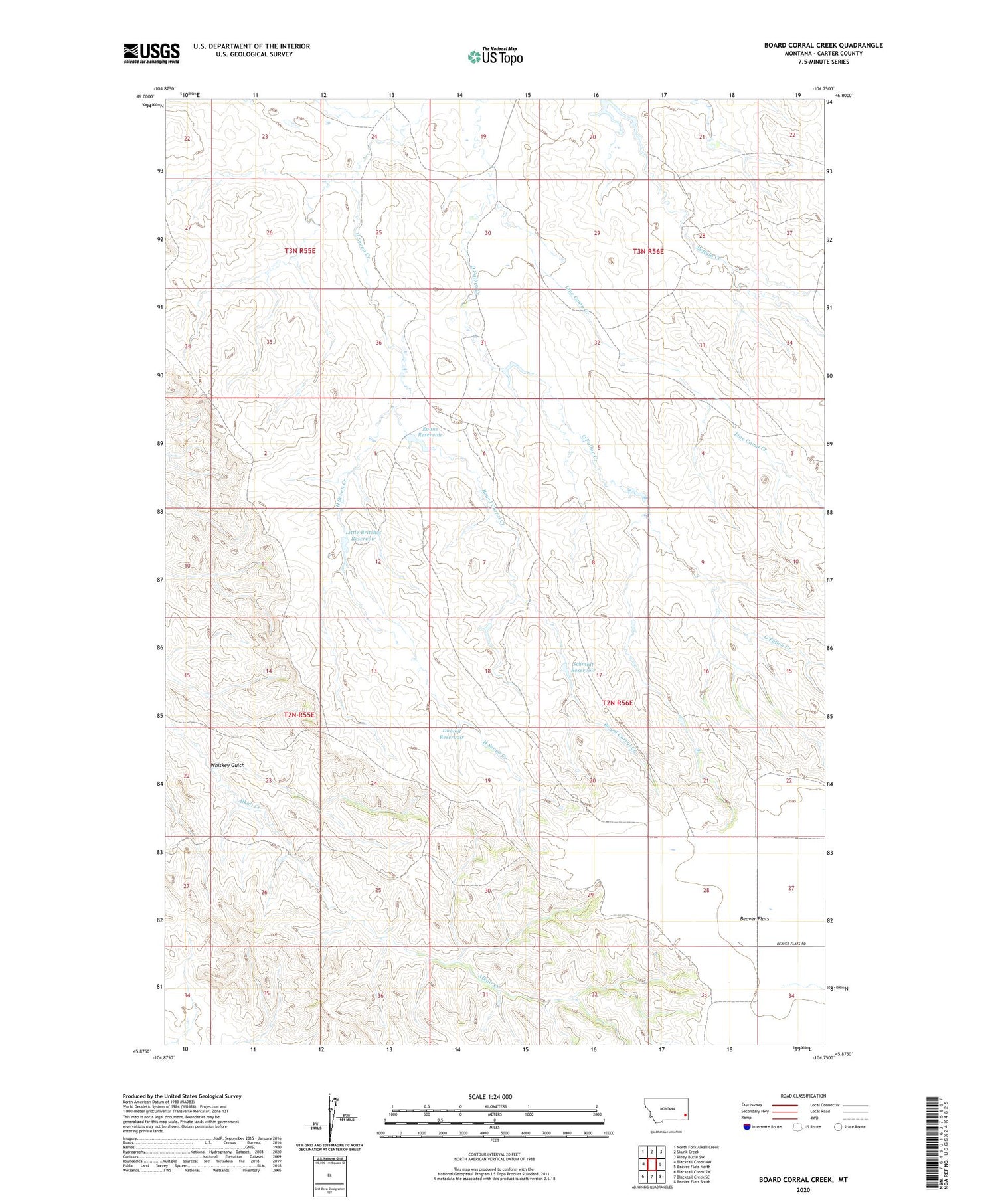
2020 topographic map quadrangle Board Corral Creek in the state of Montana. Scale: 1:24000. Based on the newly updated USGS 7.5' US Topo map series, this map is in the following counties: Carter. The map contains contour data, water features, and other items you are used to seeing on USGS maps, but also has updated roads and other features. This is the next generation of topographic maps. Printed on high-quality waterproof paper with UV fade-resistant inks.
Quads adjacent to this one:
West: Blacktail Creek NW
Northwest: North Fork Alkali Creek
North: Skunk Creek
Northeast: Piney Butte SW
East: Beaver Flats North
Southeast: Beaver Flats South
South: Blacktail Creek SE
Southwest: Blacktail Creek SW
Contains the following named places: 02N55E35CAB_01 Well, 02N56E04DCBC01 Well, 02N56E09ACB_01 Well, 02N56E28DDD_01 Well, 03N56E22DDAC01 Well, 03N56E33DC__01 Well, Board Corral Creek, Dugout Reservoir, Evans Reservoir, Line Camp Creek, Little Britches Reservoir, Schmidt Reservoir, Whiskey Gulch


