MyTopo
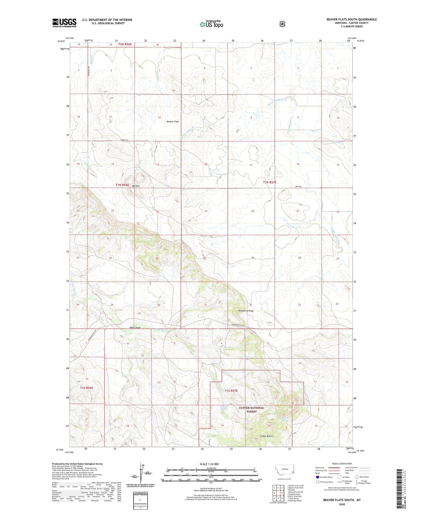
Beaver Flats South Montana US Topo Map
Couldn't load pickup availability
Also explore the Beaver Flats South Forest Service Topo of this same quad for updated USFS data
2024 topographic map quadrangle Beaver Flats South in the state of Montana. Scale: 1:24000. Based on the newly updated USGS 7.5' US Topo map series, this map is in the following counties: Carter. The map contains contour data, water features, and other items you are used to seeing on USGS maps, but also has updated roads and other features. This is the next generation of topographic maps. Printed on high-quality waterproof paper with UV fade-resistant inks.
Quads adjacent to this one:
West: Blacktail Creek SE
Northwest: Board Corral Creek
North: Beaver Flats North
Northeast: Ekalaka
East: Stagville Draw
Southeast: Dead Boy Divide
South: Chalk Buttes
Southwest: Davis Creek East
This map covers the same area as the classic USGS quad with code o45104g6.
Contains the following named places: 01N56E24BDDA01 Well, 01N57E19AABB01 Well, 01N57E19CDB_01 Well, 01S47E17DAA_01 Well, 01S57E16AC__01 Well, 01S57E17CDA_01 Well, 02N57E15ABAC01 Well, Beaver Flats, Big Hill, Bronco Sam Spring, Hehn Draw, Michael Spring, Newberry Knob, North Harkins Well, Sheep Camp Creek, South Harkins Well