MyTopo
Piney Butte SW Montana US Topo Map
Couldn't load pickup availability
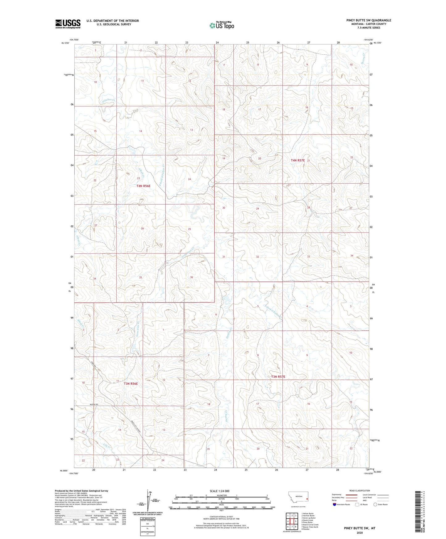
2024 topographic map quadrangle Piney Butte SW in the state of Montana. Scale: 1:24000. Based on the newly updated USGS 7.5' US Topo map series, this map is in the following counties: Carter. The map contains contour data, water features, and other items you are used to seeing on USGS maps, but also has updated roads and other features. This is the next generation of topographic maps. Printed on high-quality waterproof paper with UV fade-resistant inks.
Quads adjacent to this one:
West: Skunk Creek
Northwest: Nelson Butte
North: Harmon Butte
Northeast: Seven-up Butte
East: Piney Butte
Southeast: Ekalaka
South: Beaver Flats North
Southwest: Board Corral Creek
This map covers the same area as the classic USGS quad with code o46104a6.
Contains the following named places: 03N56E02DDCA01 Well, 03N56E10BDCA01 Well, 03N57E06DCCD01 Well, 04N56E08ABB_01 Well, 04N56E09DBDB01 Well, 04N56E10ACC_01 Well, 04N56E14CCCB01 Well, 04N56E16CAD_01 Well, 04N56E23CC__01 Well, 04N56E25DDCC01 Well, 04N56E32BCDC01 Well, 04N57E22BDDD01 Well, Alkali Creek, Chausse, Chausse Post Office, East Fork O'Fallon Creek, Hanley Creek, Lone Tree Creek