MyTopo
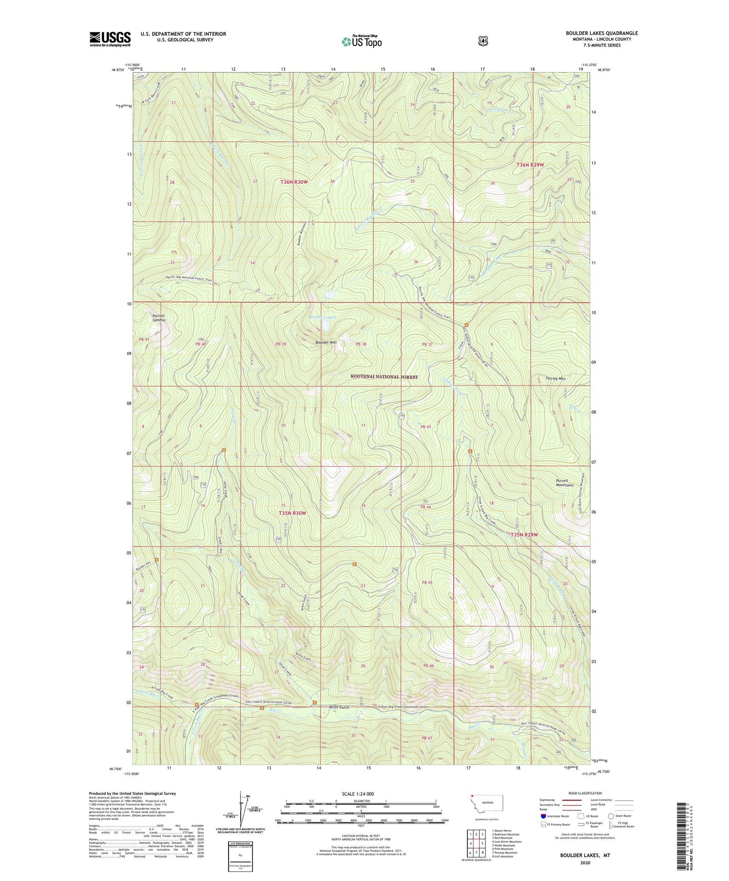
Boulder Lakes Montana US Topo Map
Couldn't load pickup availability
Also explore the Boulder Lakes Forest Service Topo of this same quad for updated USFS data
2024 topographic map quadrangle Boulder Lakes in the state of Montana. Scale: 1:24000. Based on the newly updated USGS 7.5' US Topo map series, this map is in the following counties: Lincoln. The map contains contour data, water features, and other items you are used to seeing on USGS maps, but also has updated roads and other features. This is the next generation of topographic maps. Printed on high-quality waterproof paper with UV fade-resistant inks.
Quads adjacent to this one:
West: Lost Horse Mountain
Northwest: Mount Henry
North: Robinson Mountain
Northeast: Red Mountain
East: Webb Mountain
Southeast: Inch Mountain
South: Parsnip Mountain
Southwest: Pink Mountain
This map covers the same area as the classic USGS quad with code o48115g4.
Contains the following named places: Big Creek Cabin, Boulder Lakes, Boulder Mountain, Good Creek, Knife Gulch, Little North Fork Falls, North Fork Big Creek, North Fork Boulder Creek, South Fork Big Creek, Steep Creek, Thirsty Mountain