MyTopo
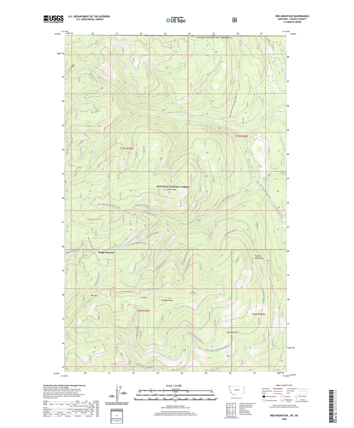
Red Mountain Montana US Topo Map
Couldn't load pickup availability
Also explore the Red Mountain Forest Service Topo of this same quad for updated USFS data
2024 topographic map quadrangle Red Mountain in the state of Montana. Scale: 1:24000. Based on the newly updated USGS 7.5' US Topo map series, this map is in the following counties: Lincoln. The map contains contour data, water features, and other items you are used to seeing on USGS maps, but also has updated roads and other features. This is the next generation of topographic maps. Printed on high-quality waterproof paper with UV fade-resistant inks.
Quads adjacent to this one:
West: Robinson Mountain
Northwest: Robinson Mountain OE N
North: Red Mountain OE N
East: Rexford
Southeast: Beartrap Mountain
South: Webb Mountain
Southwest: Boulder Lakes
This map covers the same area as the classic USGS quad with code o48115h3.
Contains the following named places: Clingback Mountain, Dodge Summit, Marias Mountain, Middle Fork Dodge Creek, North Fork Dodge Creek, North Fork Sullivan Creek, Red Mountain, Red Mountain Snow Gage, South Fork Dodge Creek, South Fork Sullivan Creek, South Fork Young Creek