MyTopo
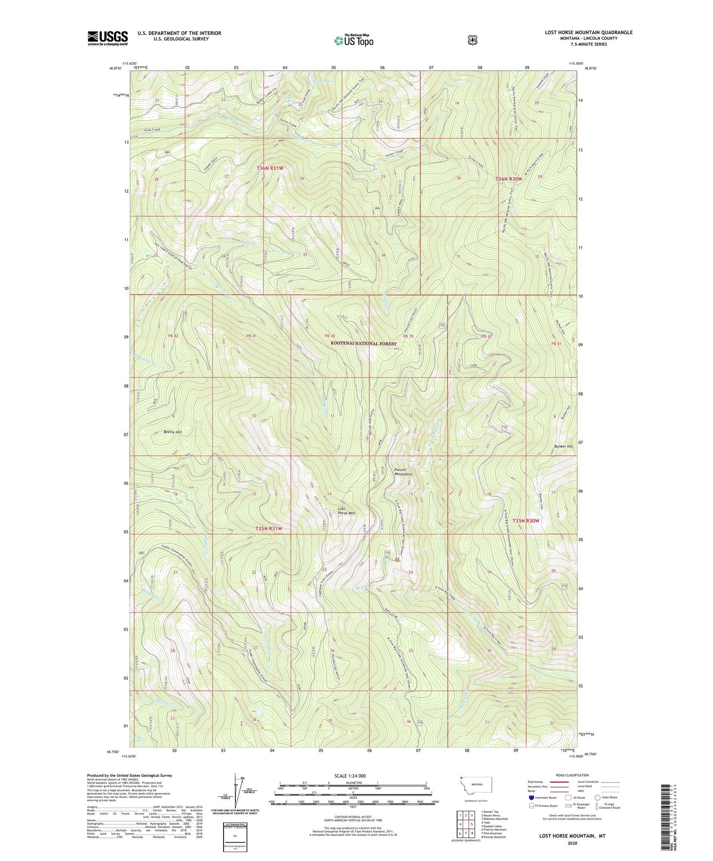
Lost Horse Mountain Montana US Topo Map
Couldn't load pickup availability
Also explore the Lost Horse Mountain Forest Service Topo of this same quad for updated USFS data
2024 topographic map quadrangle Lost Horse Mountain in the state of Montana. Scale: 1:24000. Based on the newly updated USGS 7.5' US Topo map series, this map is in the following counties: Lincoln. The map contains contour data, water features, and other items you are used to seeing on USGS maps, but also has updated roads and other features. This is the next generation of topographic maps. Printed on high-quality waterproof paper with UV fade-resistant inks.
Quads adjacent to this one:
West: Yaak
Northwest: Bonnet Top
North: Mount Henry
Northeast: Robinson Mountain
East: Boulder Lakes
Southeast: Parsnip Mountain
South: Pink Mountain
Southwest: Flatiron Mountain
This map covers the same area as the classic USGS quad with code o48115g5.
Contains the following named places: Beetle Hill, Bunker Hill, Lost Horse Mountain, Mesler Creek, Purcell Summit, Roberts Creek, Turner Creek, Turner Falls, Yodlin Creek