MyTopo
Box Canyon Coulee Montana US Topo Map
Couldn't load pickup availability
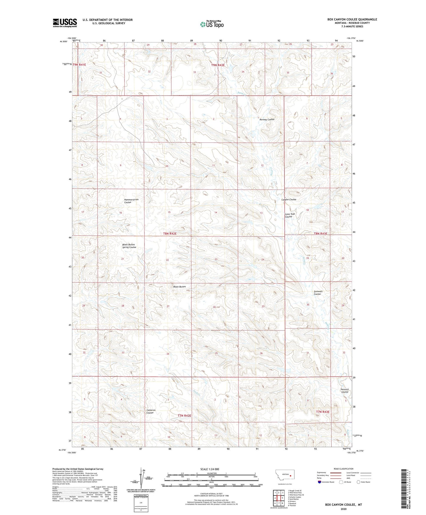
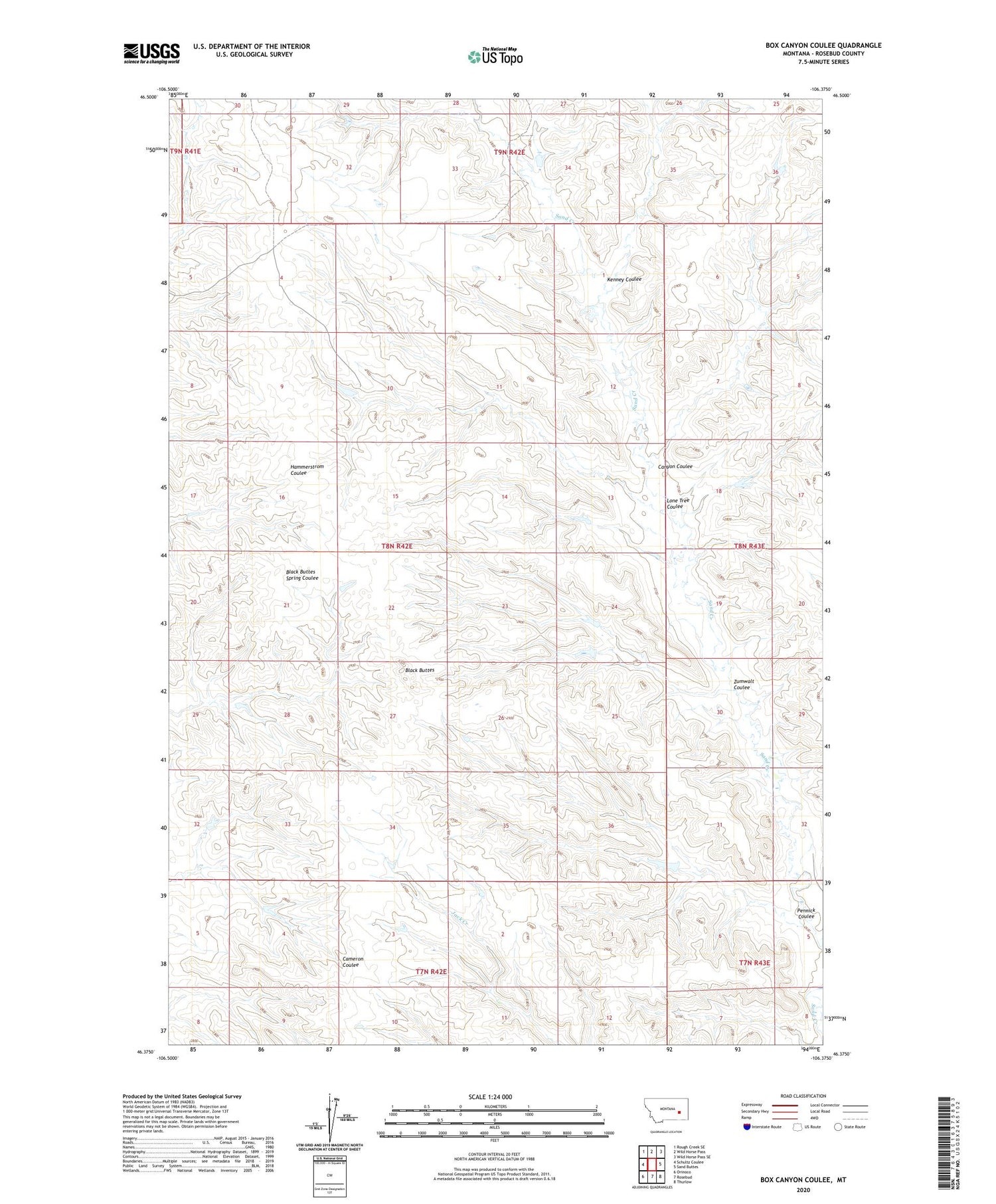
2020 topographic map quadrangle Box Canyon Coulee in the state of Montana. Scale: 1:24000. Based on the newly updated USGS 7.5' US Topo map series, this map is in the following counties: Rosebud. The map contains contour data, water features, and other items you are used to seeing on USGS maps, but also has updated roads and other features. This is the next generation of topographic maps. Printed on high-quality waterproof paper with UV fade-resistant inks.
Quads adjacent to this one:
West: Schultz Coulee
Northwest: Rough Creek SE
North: Wild Horse Pass
Northeast: Wild Horse Pass SE
East: Sand Buttes
Southeast: Thurlow
South: Rosebud
Southwest: Orinoco
Contains the following named places: 07N43E08____01 Well, Barley Reservoir Dam, Black Buttes, Canyon Coulee, Hook Number 39 Dam, Hook Number 46 Dam, Hook Number 49 Dam, Hook Number 66 Dam, Kenney Coulee, Lone Tree Coulee, Pennick Coulee, Swart Number 10 Dam, Swart Number 5 Dam, Swart Number 7 Dam, Swart Number 8 Dam, Zumwalt Coulee