MyTopo
Orinoco Montana US Topo Map
Couldn't load pickup availability
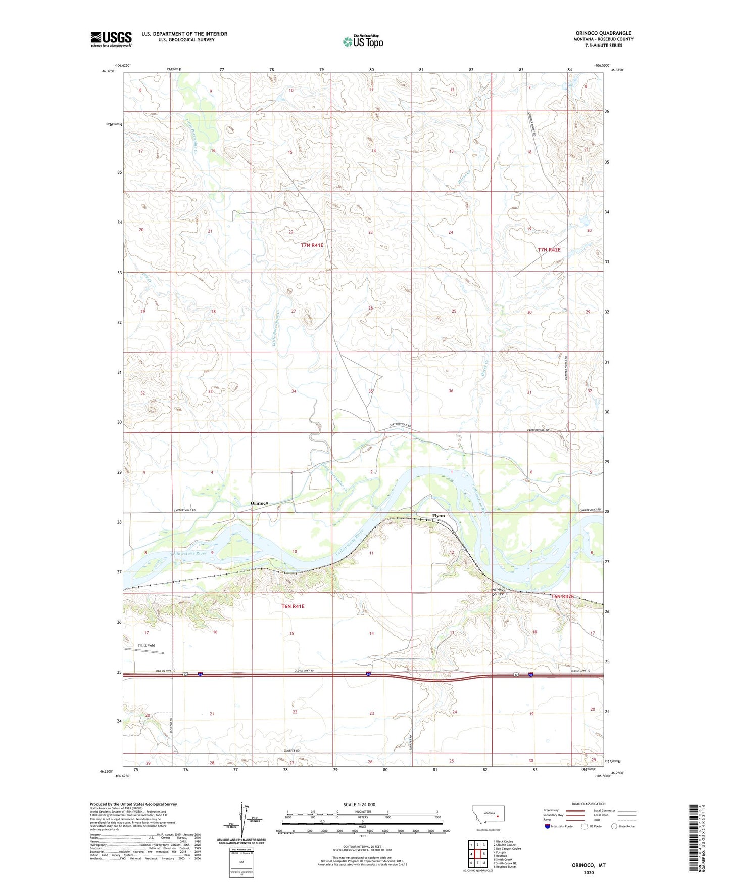
2024 topographic map quadrangle Orinoco in the state of Montana. Scale: 1:24000. Based on the newly updated USGS 7.5' US Topo map series, this map is in the following counties: Rosebud. The map contains contour data, water features, and other items you are used to seeing on USGS maps, but also has updated roads and other features. This is the next generation of topographic maps. Printed on high-quality waterproof paper with UV fade-resistant inks.
Quads adjacent to this one:
West: Forsyth
Northwest: Black Coulee
North: Schultz Coulee
Northeast: Box Canyon Coulee
East: Rosebud
Southeast: Rosebud Buttes
South: Smith Creek NE
Southwest: Smith Creek
This map covers the same area as the classic USGS quad with code o46106c5.
Contains the following named places: 06N41E08D___01 Well, 06N41E10BB__01 Well, 06N41E10C___01 Well, 06N41E16C___01 Well, 07N41E35C___01 Well, Camp Alarm, Dewey, Dry Creek, Flynn, Hayden School, Horse Creek, Lantry, Little Porcupine, Little Porcupine Creek, Montgomery Number 1 Dam, Orinoco, Orinoco School, Tillitt Field, Wildcat Coulee