MyTopo
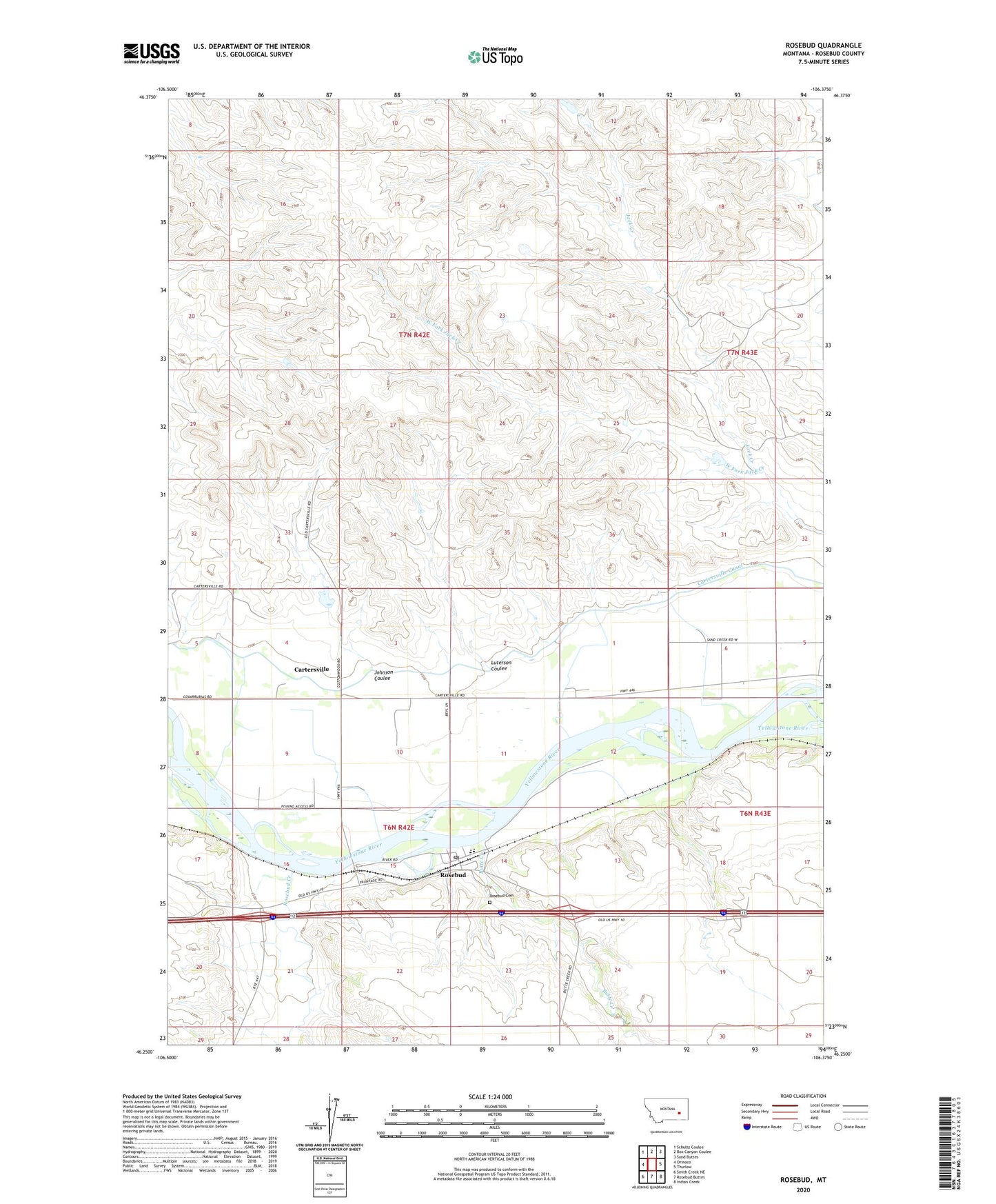
Rosebud Montana US Topo Map
Couldn't load pickup availability
2024 topographic map quadrangle Rosebud in the state of Montana. Scale: 1:24000. Based on the newly updated USGS 7.5' US Topo map series, this map is in the following counties: Rosebud. The map contains contour data, water features, and other items you are used to seeing on USGS maps, but also has updated roads and other features. This is the next generation of topographic maps. Printed on high-quality waterproof paper with UV fade-resistant inks.
Quads adjacent to this one:
West: Orinoco
Northwest: Schultz Coulee
North: Box Canyon Coulee
Northeast: Sand Buttes
East: Thurlow
Southeast: Indian Creek
South: Rosebud Buttes
Southwest: Smith Creek NE
This map covers the same area as the classic USGS quad with code o46106c4.
Contains the following named places: 06N42E02D___01 Well, 06N42E09A___01 Well, 06N42E12AA__01 Well, 06N42E14C___01 Well, 06N42E16DA__01 Well, 06N42E20DDDD01 Well, 06N42E22ACBB01 Well, 06N43E06D___01 Well, 07N42E35DDCC01 Well, 08N46E15BCD_01 Well, Albright, Albright Post Office, Butte Creek, Butte Creek School, Cartersville, Cartersville Canal, Cartersville Post Office, Carterville, Far West Fishing Access Site, Fort Sarpy, Fort Van Buren, Hook Number 61 Dam, Johnson Coulee, Luterson Coulee, Rosebud, Rosebud Cemetery, Rosebud Census Designated Place, Rosebud Community Chapel, Rosebud Creek, Rosebud Grain Elevator, Rosebud Post Office, Rosebud River Historical Marker, Rosebud School, West Fork Jack Creek