MyTopo
Schultz Coulee Montana US Topo Map
Couldn't load pickup availability
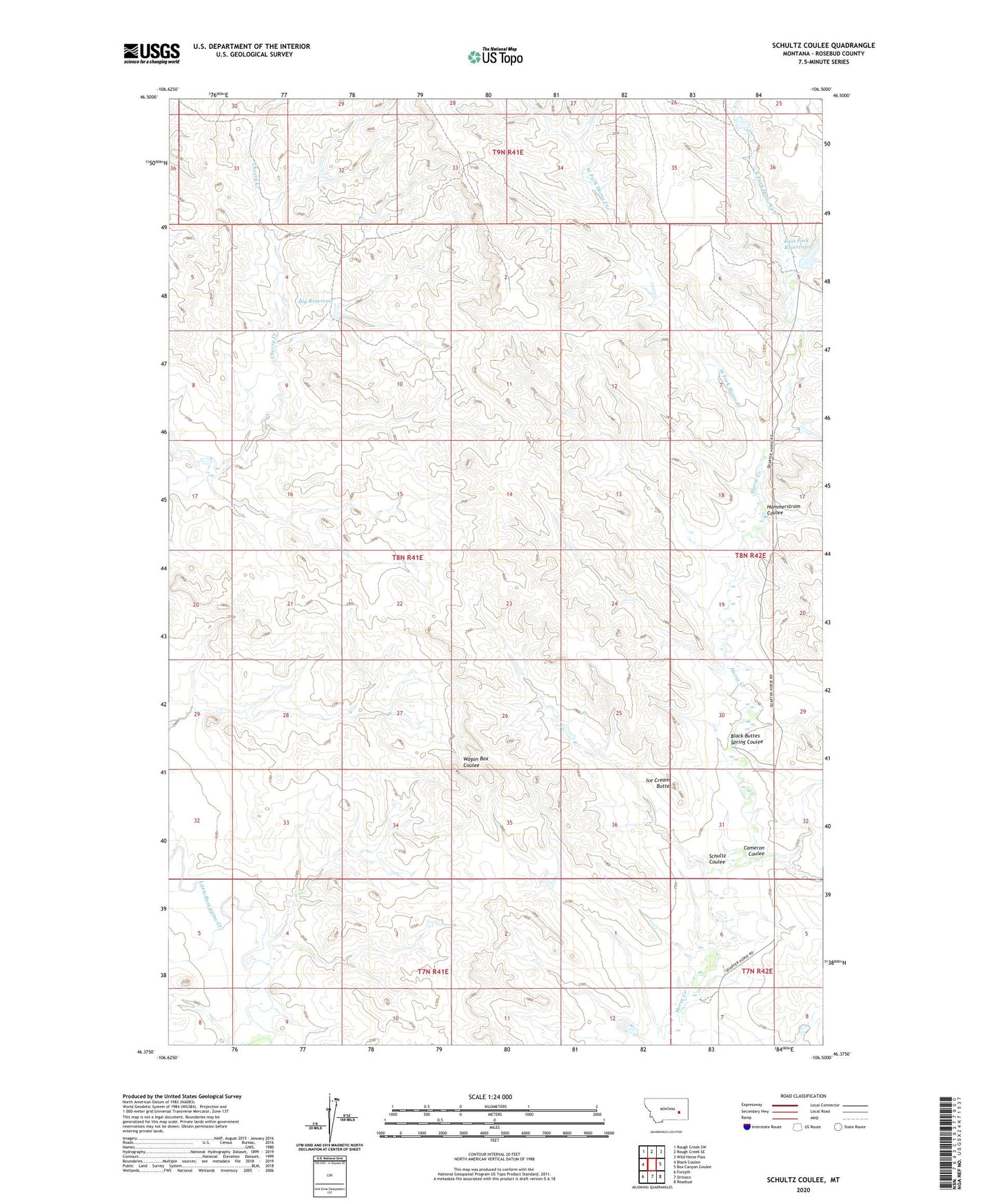
2024 topographic map quadrangle Schultz Coulee in the state of Montana. Scale: 1:24000. Based on the newly updated USGS 7.5' US Topo map series, this map is in the following counties: Rosebud. The map contains contour data, water features, and other items you are used to seeing on USGS maps, but also has updated roads and other features. This is the next generation of topographic maps. Printed on high-quality waterproof paper with UV fade-resistant inks.
Quads adjacent to this one:
West: Black Coulee
Northwest: Rough Creek SW
North: Rough Creek SE
Northeast: Wild Horse Pass
East: Box Canyon Coulee
Southeast: Rosebud
South: Orinoco
Southwest: Forsyth
This map covers the same area as the classic USGS quad with code o46106d5.
Contains the following named places: Adams Number 5 Dam, Big Reservoir, Big Reservoir Dam, Black Buttes Spring Coulee, Cameron Coulee, Cherry Creek Dam, East Fork Horse Creek, East Fork Reservoir, East Fork Reservoir Dam, Hammerstrom Coulee, Horse Creek Dam, Horse Creek School, Ice Cream Butte, Schultz Coulee, Swart Number 9 Dam, West Fork Horse Creek, Whaley Number 10 Dam