MyTopo
Brandenberg Montana US Topo Map
Couldn't load pickup availability
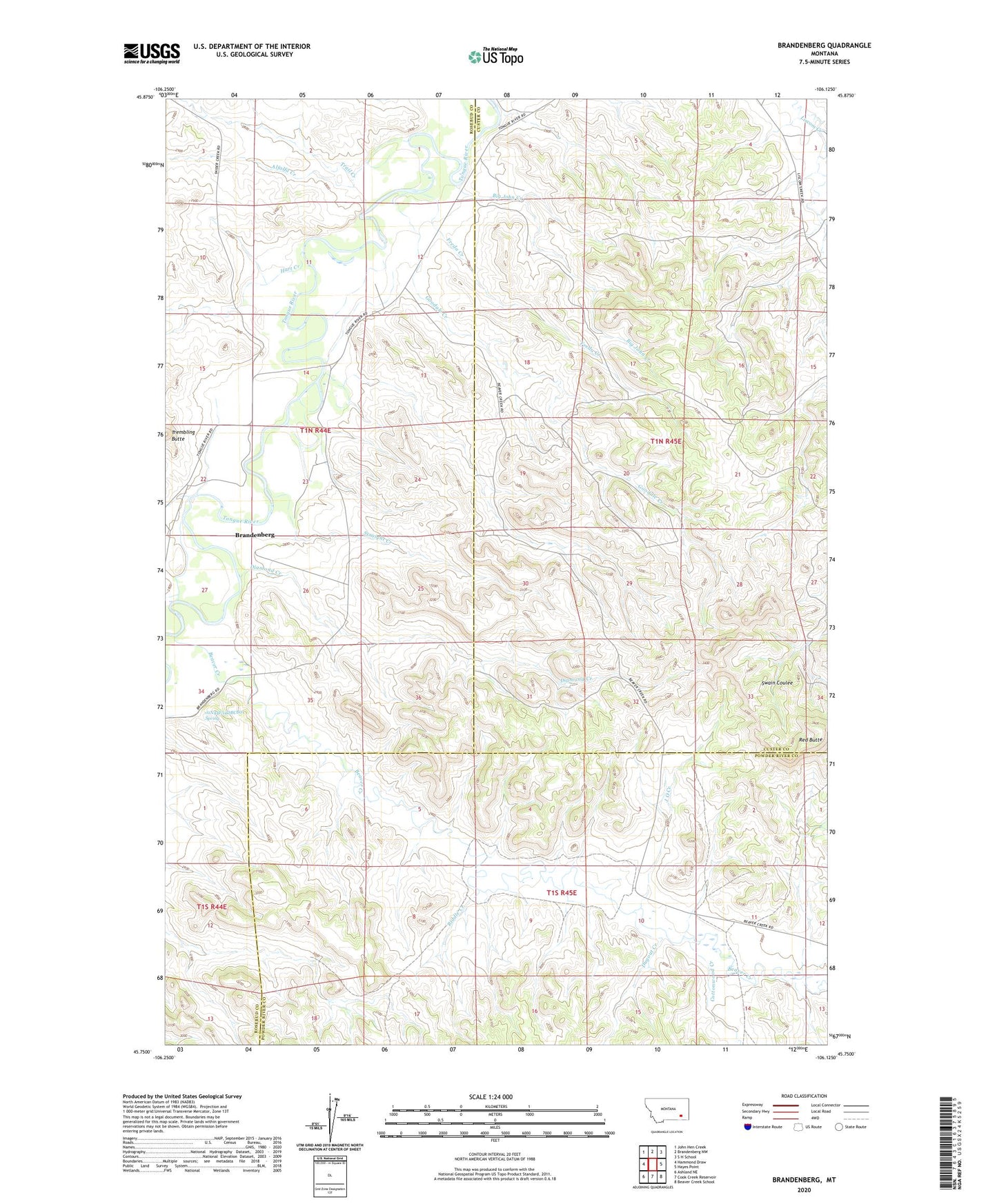
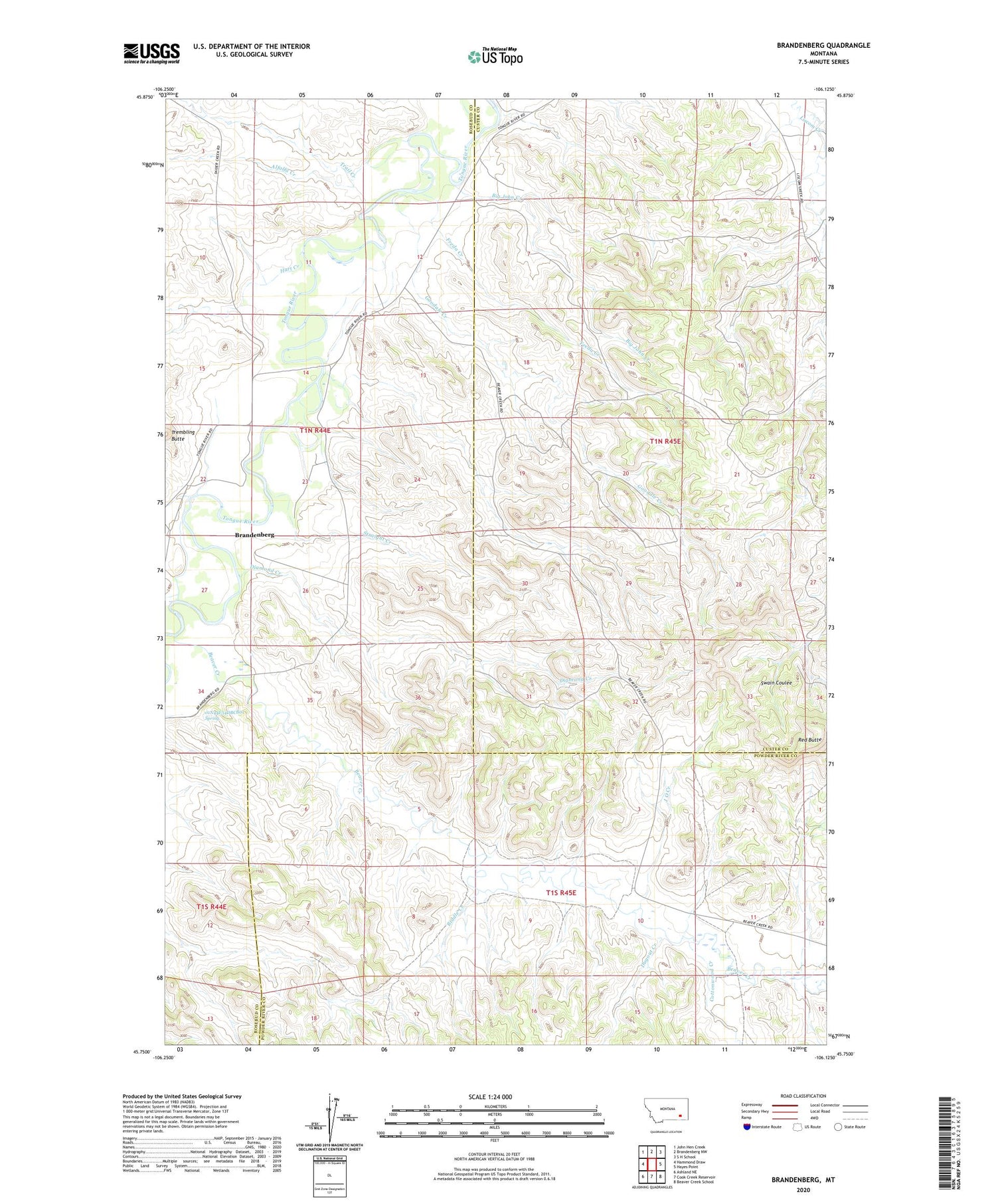
2020 topographic map quadrangle Brandenberg in the state of Montana. Scale: 1:24000. Based on the newly updated USGS 7.5' US Topo map series, this map is in the following counties: Custer, Rosebud, Powder River. The map contains contour data, water features, and other items you are used to seeing on USGS maps, but also has updated roads and other features. This is the next generation of topographic maps. Printed on high-quality waterproof paper with UV fade-resistant inks.
Quads adjacent to this one:
West: Hammond Draw
Northwest: John Hen Creek
North: Brandenberg NW
Northeast: S H School
East: Hayes Point
Southeast: Beaver Creek School
South: Cook Creek Reservoir
Southwest: Ashland NE
Contains the following named places: 01N44E01ACBA01 Well, 01N44E01CBBD01 Well, 01N44E02BCBD01 Well, 01N44E10ABAC01 Well, 01N44E12C___01 Well, 01N44E12CBCA01 Well, 01N44E12CBCD01 Well, 01N44E12CBCD02 Well, 01N44E12CBCD03 Well, 01N44E14BBDC01 Well, 01N44E14BBDC02 Well, 01N44E14BCAB01 Well, 01N44E22AADA01 Well, 01N44E22C___01 Well, 01N44E27BDBC01 Well, 01N44E34CABD01 Well, 01N44E34DBCB01 Spring, 01N45E06BCBA01 Well, 01N45E17DCBB01 Well, 01N45E18CABB01 Well, 01N45E32DDDC01 Well, 01S45E05DBDC01 Well, 01S45E10BADD01 Well, 01S45E11CBBA01 Well, Alfalfa Creek, Beaver Creek, Big John Creek, Brandenberg, Brandenberg Post Office, Cottonwood Creek, Diamond Creek, Dugout Creek, Freda Creek, Goodale Creek, Hart Creek, J O Creek, Joe Leg Creek, Red Butte, Riddle Creek, Straight Creek, Trail Creek