MyTopo
Brandenberg NW Montana US Topo Map
Couldn't load pickup availability
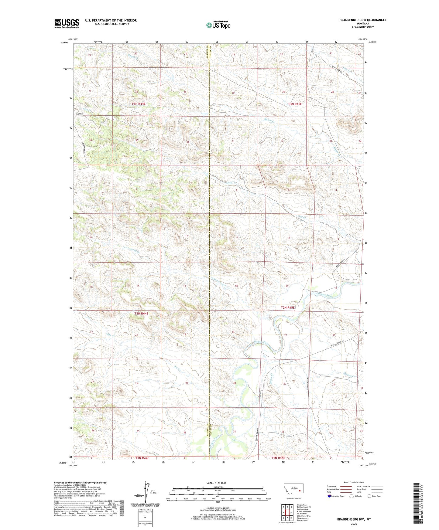
2024 topographic map quadrangle Brandenberg NW in the state of Montana. Scale: 1:24000. Based on the newly updated USGS 7.5' US Topo map series, this map is in the following counties: Custer, Rosebud. The map contains contour data, water features, and other items you are used to seeing on USGS maps, but also has updated roads and other features. This is the next generation of topographic maps. Printed on high-quality waterproof paper with UV fade-resistant inks.
Quads adjacent to this one:
West: John Hen Creek
Northwest: Crain Place
North: Miller Creek SW
Northeast: Miller Creek
East: S H School
Southeast: Hayes Point
South: Brandenberg
Southwest: Hammond Draw
This map covers the same area as the classic USGS quad with code o45106h2.
Contains the following named places: 02N44E13ACBB01 Well, 02N44E23DCBA01 Well, 02N44E24CDCC01 Well, 02N45E03BBBA01 Well, 02N45E20CDDC01 Well, 02N45E20CDDD01 Well, 02N45E32CBBB01 Well, 03N44E25ACDC01 Well, 03N44E25ACDC02 Well, Cottonwood Creek, Dry Creek, Garden Creek, Liscom Creek, Pope, Trail Creek School