MyTopo
Broadview NE Montana US Topo Map
Couldn't load pickup availability
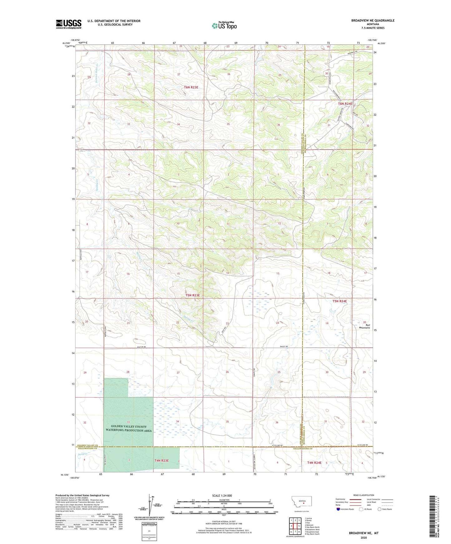
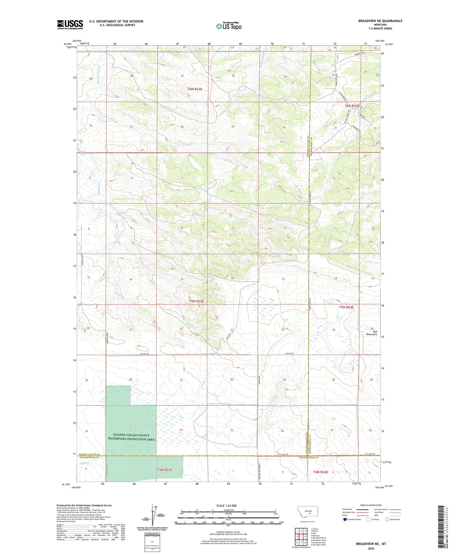
2020 topographic map quadrangle Broadview NE in the state of Montana. Scale: 1:24000. Based on the newly updated USGS 7.5' US Topo map series, this map is in the following counties: Golden Valley, Musselshell, Yellowstone. The map contains contour data, water features, and other items you are used to seeing on USGS maps, but also has updated roads and other features. This is the next generation of topographic maps. Printed on high-quality waterproof paper with UV fade-resistant inks.
Quads adjacent to this one:
West: Belmont
Northwest: Lavina
North: Bundy
Northeast: Elso
East: Hay Basin North
Southeast: Hay Basin South
South: Broadview East
Southwest: Broadview West
Contains the following named places: 05N24E30ACDA01 Well, 06N23E25CCBC01 Well, 06N23E35CCCB01 Well, 08N32E06CD__01 Well, Golden Valley County Waterfowl Production Area, Sand Creek, Spring Creek