MyTopo
Elso Montana US Topo Map
Couldn't load pickup availability
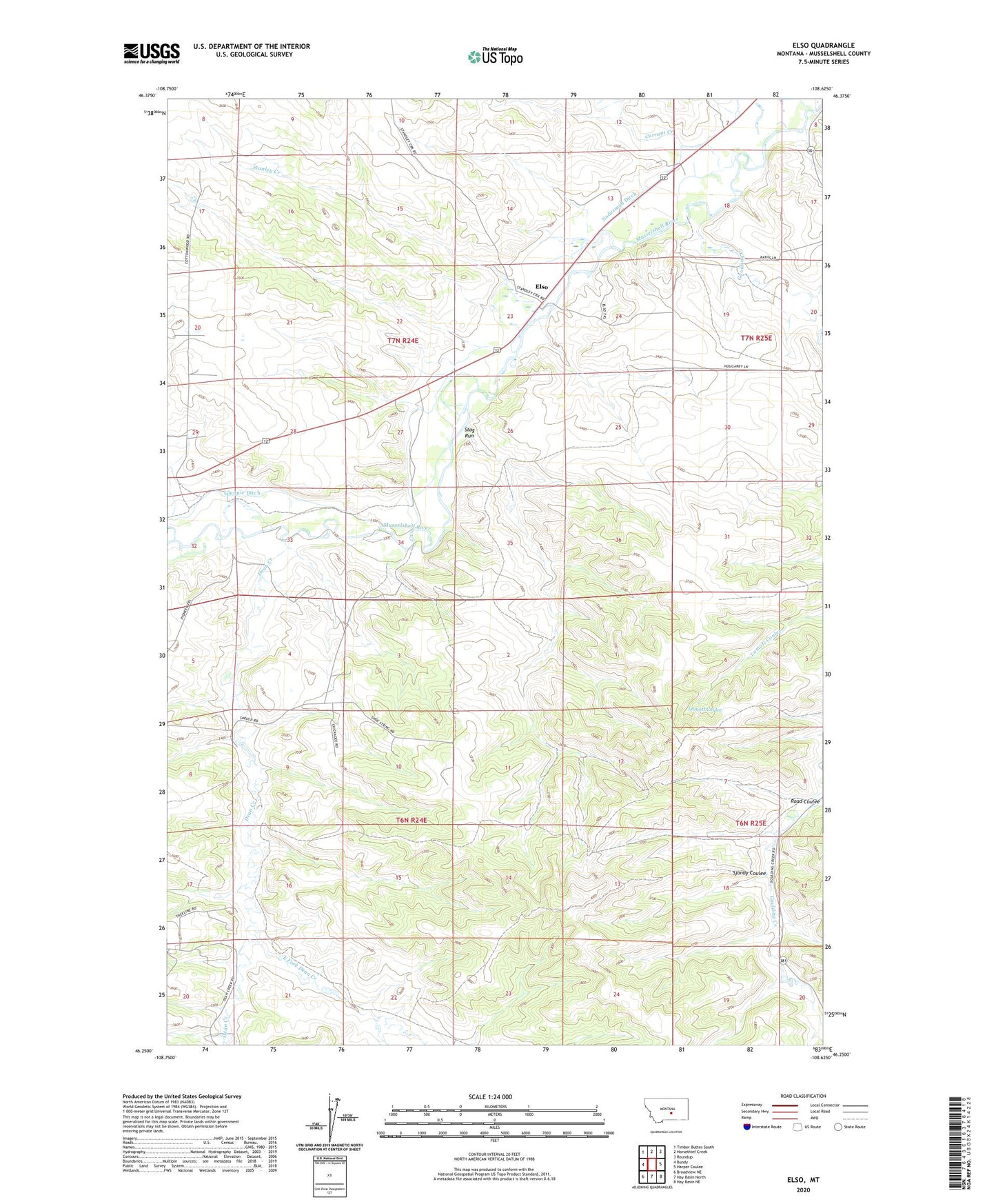
2024 topographic map quadrangle Elso in the state of Montana. Scale: 1:24000. Based on the newly updated USGS 7.5' US Topo map series, this map is in the following counties: Musselshell. The map contains contour data, water features, and other items you are used to seeing on USGS maps, but also has updated roads and other features. This is the next generation of topographic maps. Printed on high-quality waterproof paper with UV fade-resistant inks.
Quads adjacent to this one:
West: Bundy
Northwest: Timber Buttes South
North: Horsethief Creek
Northeast: Roundup
East: Harper Coulee
Southeast: Hay Basin NE
South: Hay Basin North
Southwest: Broadview NE
This map covers the same area as the classic USGS quad with code o46108c6.
Contains the following named places: 06N24E04DDAB01 Well, 06N24E08AABA01 Well, 06N24E14CDDB01 Well, 07N24E13AACC01 Well, 07N24E13BDAA01 Well, 07N24E13BDDD01 Well, 07N24E14ADDA01 Well, 07N24E15BAA_01 Well, 07N24E24DCCA01 Well, 07N24E24DDDD01 Well, 07N24E28ADBA01 Well, 07N25E19DDDA01 Well, 18N23E12CBC_01 Well, Barott Post Office, Currant Creek, Dean Creek, East Fork Dean Creek, Elso, Elso Post Office, Elso School, Goulding Creek, Naderman Dam, Road Coulee, Sjandy Coulee, Stag Run, Stanley Creek