MyTopo
Browns Lake Montana US Topo Map
Couldn't load pickup availability
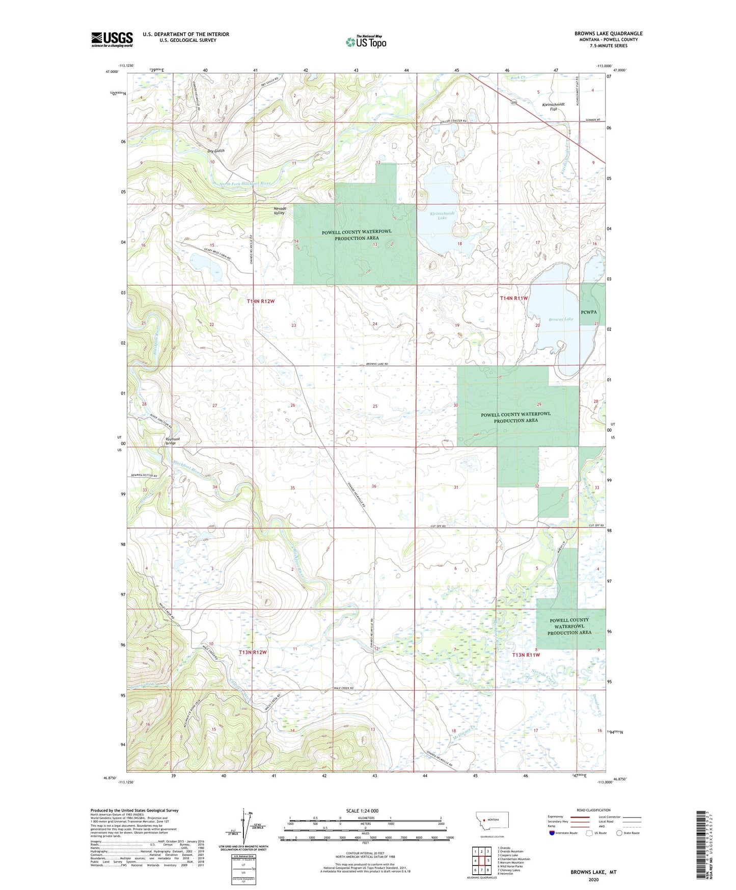
2024 topographic map quadrangle Browns Lake in the state of Montana. Scale: 1:24000. Based on the newly updated USGS 7.5' US Topo map series, this map is in the following counties: Powell. The map contains contour data, water features, and other items you are used to seeing on USGS maps, but also has updated roads and other features. This is the next generation of topographic maps. Printed on high-quality waterproof paper with UV fade-resistant inks.
Quads adjacent to this one:
West: Chamberlain Mountain
Northwest: Ovando
North: Ovando Mountain
Northeast: Coopers Lake
East: Marcum Mountain
Southeast: Helmville
South: Chimney Lakes
Southwest: Wild Horse Parks
This map covers the same area as the classic USGS quad with code o46113h1.
Contains the following named places: 13N12W12CAAA02 Well, 13N12W12CAAB01 Well, 13N12W12DCDD01 Well, 14N11W08ADAC01 Well, 14N12W22DBAD01 Well, 14N12W36DCCC01 Well, Aunt Molly Fishing Access Site, Browns Lake, Browns Lake Fishing Access Site, Cedar Meadow Fishing Access Site, Company Ditch, Douglas Creek, Dry Gulch, First Chance Creek Placer Mine, Frazier Creek, Harry Morgan Fishing Access Site, Kleinschmidt Creek, Kleinschmidt Lake, Lake City Post Office, Long Lake, McElwain Creek, Nevada Creek, Nevada Valley, Raymond Bridge, Rock Creek, Wales Creek, Ward Creek, Yourname Creek