MyTopo
Content Montana US Topo Map
Couldn't load pickup availability
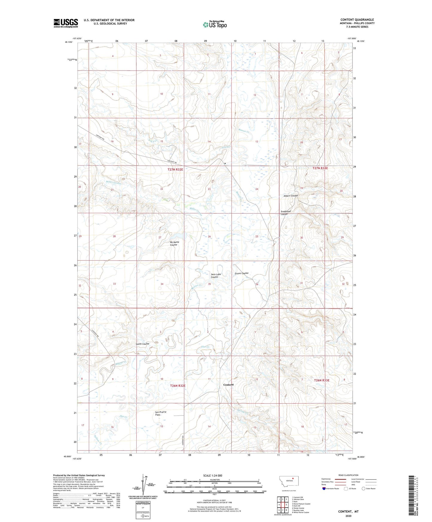
2024 topographic map quadrangle Content in the state of Montana. Scale: 1:24000. Based on the newly updated USGS 7.5' US Topo map series, this map is in the following counties: Phillips. The map contains contour data, water features, and other items you are used to seeing on USGS maps, but also has updated roads and other features. This is the next generation of topographic maps. Printed on high-quality waterproof paper with UV fade-resistant inks.
Quads adjacent to this one:
West: Horse Pasture Coulee
Northwest: Content NW
North: Johnson Dam
Northeast: Harb
East: Harb SW
Southeast: White Horse Coulee
South: Buckley Lake
Southwest: Sheep Coulee
This map covers the same area as the classic USGS quad with code o48107a5.
Contains the following named places: 26N32E08AA__01 Well, 26N32E15AA__01 Well, 26N32E16B___01 Well, 27N32E22CA__01 Well, 27N32E36DC__01 Well, Albert Coulee, Content, Content Post Office, D H S Creek, Flat Creek, Grove Coulee, Miller Coulee, No Name Coulee, Row Dam, Smith Coulee, Spring Creek, Tallow Creek, Trueblood Coulee, Twin Lake Coulee