MyTopo
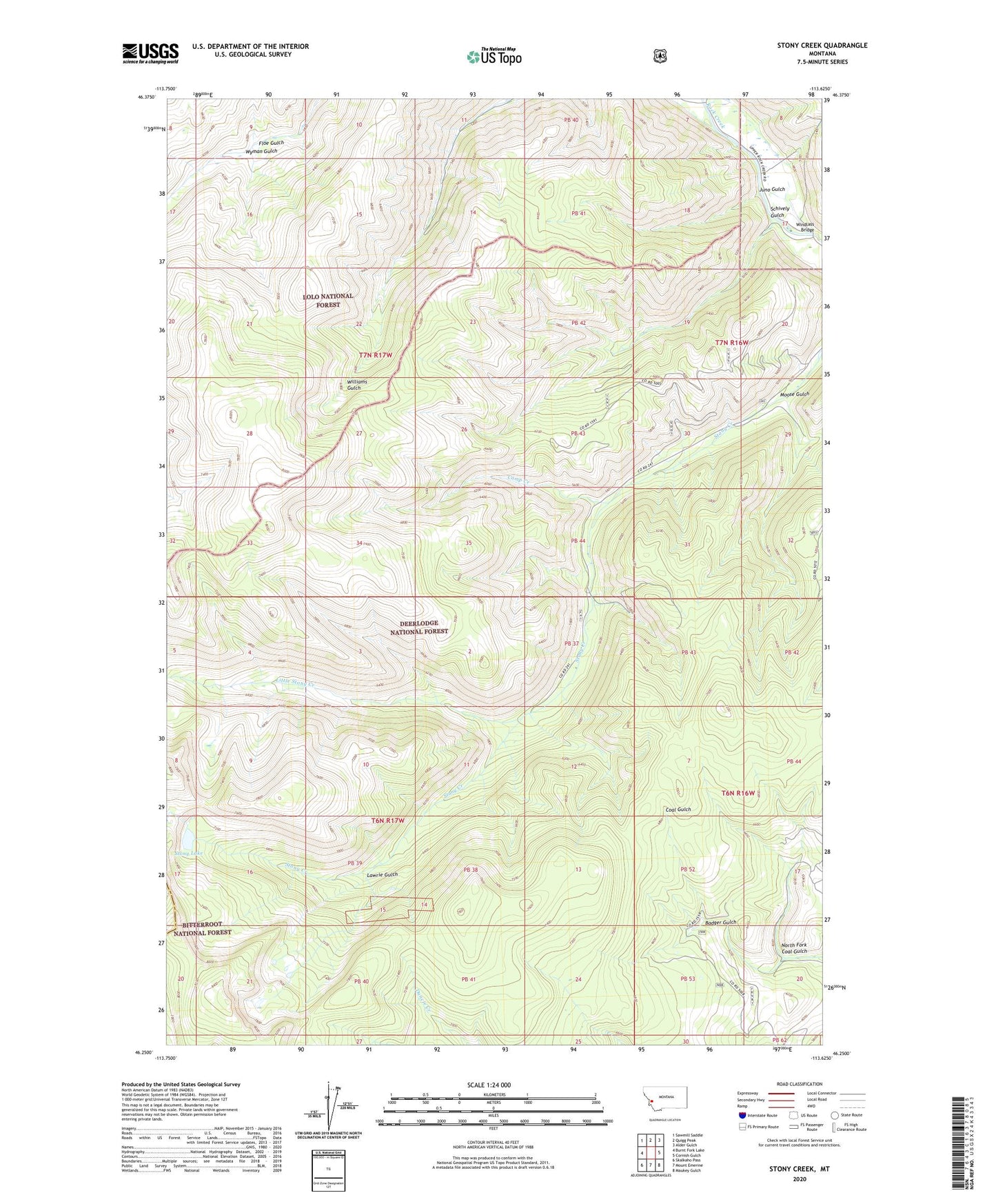
Stony Creek Montana US Topo Map
Couldn't load pickup availability
Also explore the Stony Creek Forest Service Topo of this same quad for updated USFS data
2024 topographic map quadrangle Stony Creek in the state of Montana. Scale: 1:24000. Based on the newly updated USGS 7.5' US Topo map series, this map is in the following counties: Granite, Ravalli. The map contains contour data, water features, and other items you are used to seeing on USGS maps, but also has updated roads and other features. This is the next generation of topographic maps. Printed on high-quality waterproof paper with UV fade-resistant inks.
Quads adjacent to this one:
West: Burnt Fork Lake
Northwest: Sawmill Saddle
North: Quigg Peak
Northeast: Alder Gulch
East: Cornish Gulch
Southeast: Maukey Gulch
South: Mount Emerine
Southwest: Skalkaho Pass
This map covers the same area as the classic USGS quad with code o46113c6.
Contains the following named places: Badger Gulch, Camp Creek, Floe Gulch, Juno Gulch, Lawrie Gulch, Little Stony Creek, Moose Gulch, North Fork Coal Gulch, NW NW Section 6 Mine, Schively Gulch, SE NW Section 6 Mine, SE SE Section 36 Mine, Stony Lake, SW SE Section 36 Mine, Windlass Bridge