MyTopo
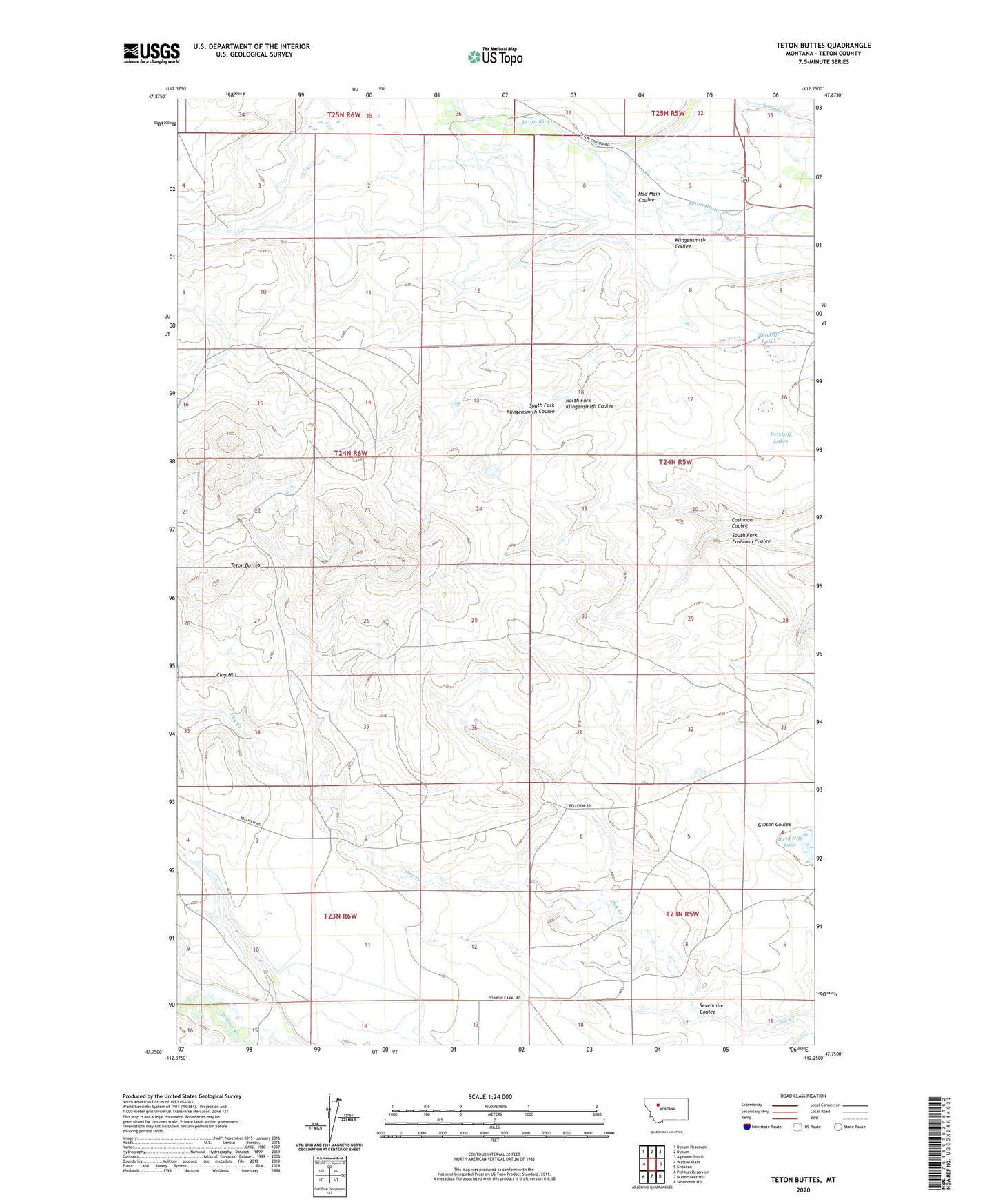
Teton Buttes Montana US Topo Map
Couldn't load pickup availability
2024 topographic map quadrangle Teton Buttes in the state of Montana. Scale: 1:24000. Based on the newly updated USGS 7.5' US Topo map series, this map is in the following counties: Teton. The map contains contour data, water features, and other items you are used to seeing on USGS maps, but also has updated roads and other features. This is the next generation of topographic maps. Printed on high-quality waterproof paper with UV fade-resistant inks.
Quads adjacent to this one:
West: Watson Flats
Northwest: Bynum Reservoir
North: Bynum
Northeast: Agawam South
East: Choteau
Southeast: Sevenmile Hill
South: Nunemaker Hill
Southwest: Pishkun Reservoir
This map covers the same area as the classic USGS quad with code o47112g3.
Contains the following named places: Blackfeet and Buffalo Historical Marker, Clay Hill, Gibson Coulee, Greyn Ranch, Hod Main Coulee, Kalma Post Office, Klingensmith Coulee, Knaff Ranch, Meadows Ranch, North Fork Klingensmith Coulee, NW NW Section 11 Mine, Reickoff Lakes, Ruebe Ranch, Sabo Ranch, SE NE Section 10 Mine, Sevenmile Coulee, South Fork Cashman Coulee, South Fork Klingensmith Coulee, SW NW Section 10 Mine, Teton Buttes