MyTopo
Lone Tree Creek Montana US Topo Map
Couldn't load pickup availability
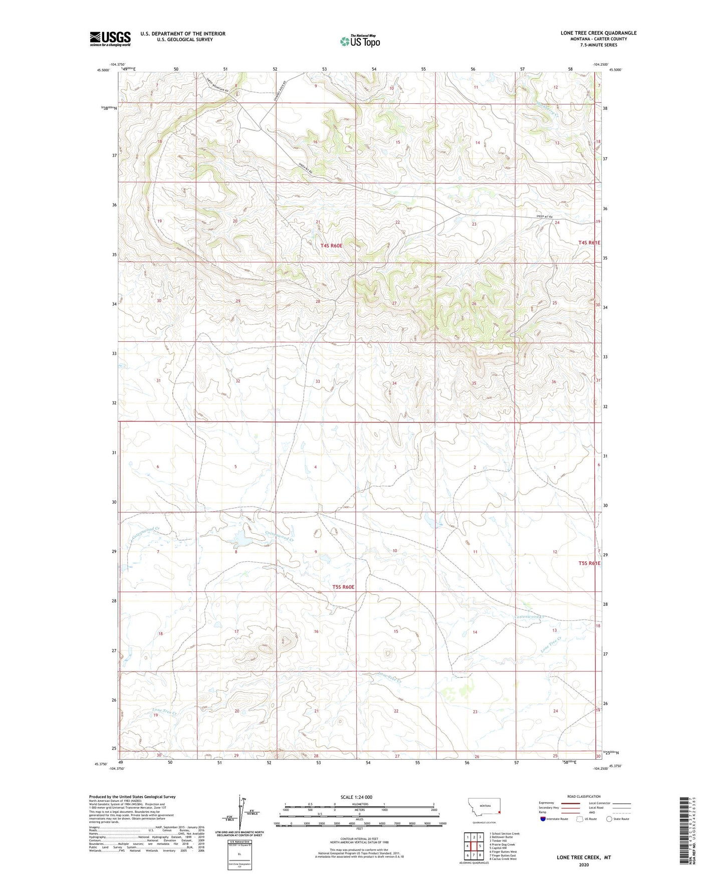
2024 topographic map quadrangle Lone Tree Creek in the state of Montana. Scale: 1:24000. Based on the newly updated USGS 7.5' US Topo map series, this map is in the following counties: Carter. The map contains contour data, water features, and other items you are used to seeing on USGS maps, but also has updated roads and other features. This is the next generation of topographic maps. Printed on high-quality waterproof paper with UV fade-resistant inks.
Quads adjacent to this one:
West: Prairie Dog Creek
Northwest: School Section Creek
North: Belltower Butte
Northeast: Timber Hill
East: Capitol NW
Southeast: Cactus Creek West
South: Finger Buttes East
Southwest: Finger Buttes West
This map covers the same area as the classic USGS quad with code o45104d3.
Contains the following named places: 04S60E08DDAD01 Well, 04S60E22CDDB01 Well, 19N58E03DBBB01 Well, Lone Tree Creek