MyTopo
Calvert Montana US Topo Map
Couldn't load pickup availability
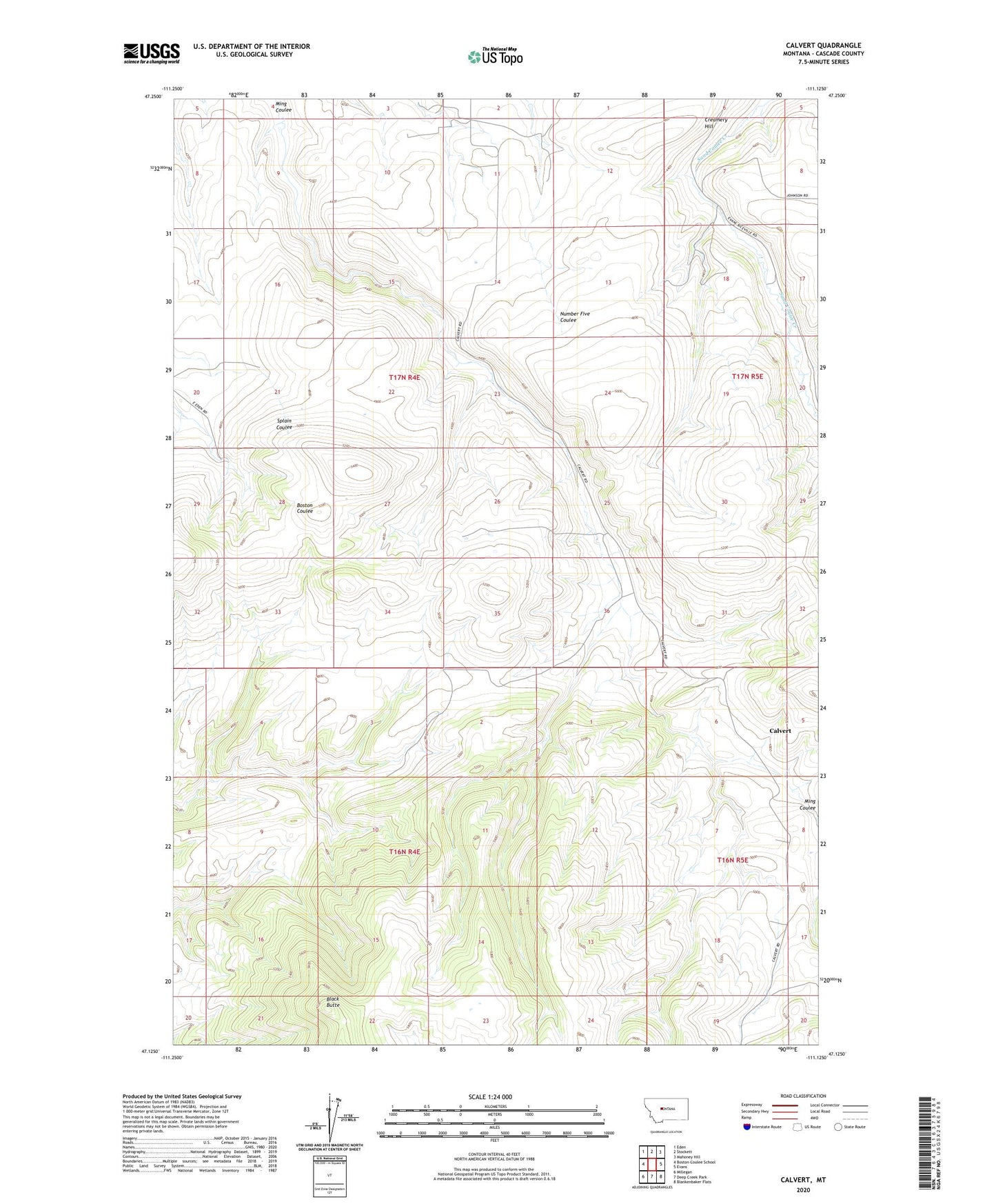
2020 topographic map quadrangle Calvert in the state of Montana. Scale: 1:24000. Based on the newly updated USGS 7.5' US Topo map series, this map is in the following counties: Cascade. The map contains contour data, water features, and other items you are used to seeing on USGS maps, but also has updated roads and other features. This is the next generation of topographic maps. Printed on high-quality waterproof paper with UV fade-resistant inks.
Quads adjacent to this one:
West: Boston Coulee School
Northwest: Eden
North: Stockett
Northeast: Mahoney Hill
East: Evans
Southeast: Blankenbaker Flats
South: Deep Creek Park
Southwest: Millegan
Contains the following named places: 17N04E11____01 Well, 59480, Betts School, Black Butte, Black Butte School, Calvert, Calvert Post Office, Calvert School, Cameron School, Creamery Hill, Eden-Stockett Division