MyTopo
Eden Montana US Topo Map
Couldn't load pickup availability
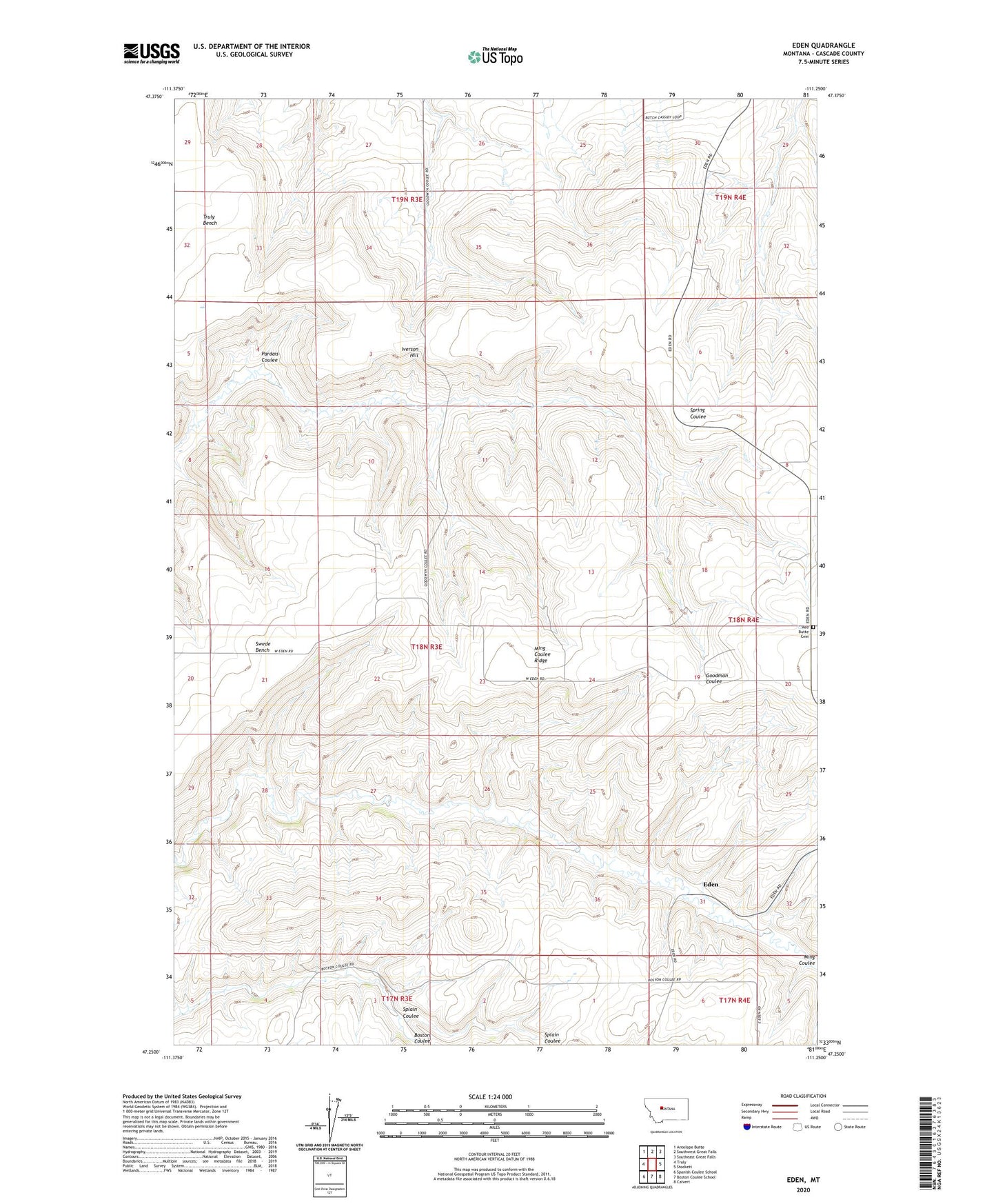
2024 topographic map quadrangle Eden in the state of Montana. Scale: 1:24000. Based on the newly updated USGS 7.5' US Topo map series, this map is in the following counties: Cascade. The map contains contour data, water features, and other items you are used to seeing on USGS maps, but also has updated roads and other features. This is the next generation of topographic maps. Printed on high-quality waterproof paper with UV fade-resistant inks.
Quads adjacent to this one:
West: Truly
Northwest: Antelope Butte
North: Southwest Great Falls
Northeast: Southeast Great Falls
East: Stockett
Southeast: Calvert
South: Boston Coulee School
Southwest: Spanish Coulee School
This map covers the same area as the classic USGS quad with code o47111c3.
Contains the following named places: 17N03E04C___01 Well, 17N03E04C___02 Well, 17N03E04C___03 Well, 17N03E04C___04 Well, 17N03E04C___05 Well, 18N03E09____01 Well, 18N03E09____02 Well, 18N03E10____01 Well, 18N03E12____01 Well, 18N03E20D___01 Well, 18N03E21____01 Well, 18N03E23B___01 Well, 18N03E28A___01 Well, 18N04E31A___01 Well, 19N04E30C___01 Well, 19N04E30DBDD01 Well, 59405, Cascade County, Eden, Eden Post Office, Eden School, Iverson Hill, McCumber School, Ming Coulee Ridge, Pardais Coulee, Pettapiece Badland, Red Butte Cemetery, Red Butte Church, Red Butte School, Saint Francis Xavier Church, Splain Coulee, Swede Bench