MyTopo
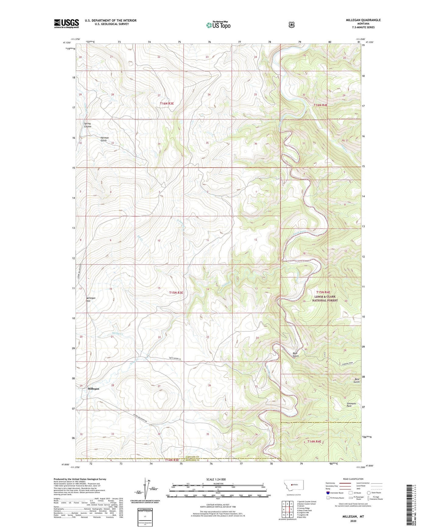
Millegan Montana US Topo Map
Couldn't load pickup availability
Also explore the Millegan Forest Service Topo of this same quad for updated USFS data
2024 topographic map quadrangle Millegan in the state of Montana. Scale: 1:24000. Based on the newly updated USGS 7.5' US Topo map series, this map is in the following counties: Cascade, Meagher. The map contains contour data, water features, and other items you are used to seeing on USGS maps, but also has updated roads and other features. This is the next generation of topographic maps. Printed on high-quality waterproof paper with UV fade-resistant inks.
Quads adjacent to this one:
West: Conway Ridge
Northwest: Spanish Coulee School
North: Boston Coulee School
Northeast: Calvert
East: Deep Creek Park
Southeast: Bald Hills
South: Lingshire NE
Southwest: Lingshire NW
This map covers the same area as the classic USGS quad with code o47111a3.
Contains the following named places: Bear Gulch, Carlson, Coal Creek, Creek Corral, Deep Creek, Dick Anderson Cabin, Fir Creek, Herman Gulch, Millegan, Millegan Hill, Millegan Post Office, North Fork Deep Creek, North Fork Fir Creek, Ray Carlson, Simmons Park, Spring Coulee, Spring Creek, Trout Creek, Trout Creek Boat Camp, Tynes, Upper Parker Flat Boat Camp