MyTopo
Stockett Montana US Topo Map
Couldn't load pickup availability
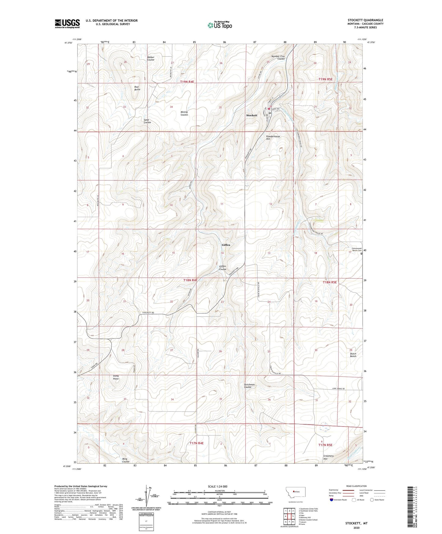
2024 topographic map quadrangle Stockett in the state of Montana. Scale: 1:24000. Based on the newly updated USGS 7.5' US Topo map series, this map is in the following counties: Cascade. The map contains contour data, water features, and other items you are used to seeing on USGS maps, but also has updated roads and other features. This is the next generation of topographic maps. Printed on high-quality waterproof paper with UV fade-resistant inks.
Quads adjacent to this one:
West: Eden
Northwest: Southwest Great Falls
North: Southeast Great Falls
Northeast: Fife
East: Mahoney Hill
Southeast: Evans
South: Calvert
Southwest: Boston Coulee School
This map covers the same area as the classic USGS quad with code o47111c2.
Contains the following named places: 17N04E02A___01 Well, 18N04E17A___01 Well, 18N04E21____01 Well, 18N04E25D___01 Well, 18N04E33____01 Well, 18N04E34A___01 Well, 18N04E34A___02 Well, 18N04E35C___01 Well, 18N04E35C___02 Well, 18N05E07BBCD01 Well, 18N05E18____01 Well, 18N05E18____02 Well, 18N05E19____01 Well, 18N05E31D___01 Well, 18N05E31D___02 Well, 18N05E31D___03 Well, 19N04E27A___01 Well, 19N04E27D___01 Well, 19N04E33C___01 Well, 19N04E36____01 Well, 19N04E36C___01 Well, Cooney School, Cottonwood Bench Cemetery, Cottonwood School, COTTONWOOD_MN_NO Spring, Dutch Bench, Dutchman Coulee, Fleming School, Giffen, Giffen Coulee, Giffen Post Office, Number Five Coulee, Powderhouse Hill, Red Butte, Sabzin Mine, Saint Cyril and Methodius Catholic Church, Selstrom School, Stockett, Stockett Census Designated Place, Stockett Community Bible Chapel, Stockett Post Office, Stockett School, Stockett Volunteer Fire Department, Stony Point