MyTopo
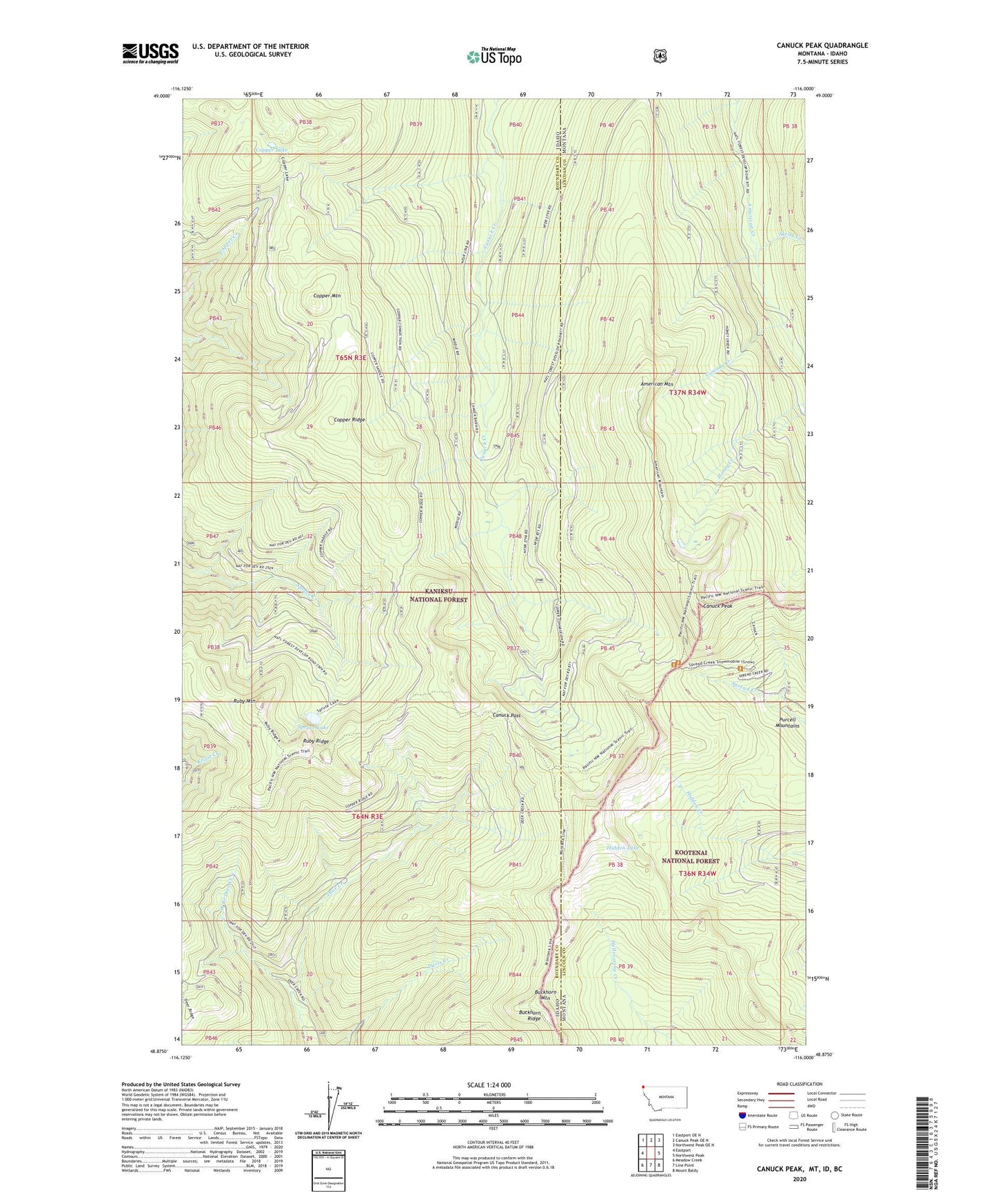
Canuck Peak Montana US Topo Map
Couldn't load pickup availability
Also explore the Canuck Peak Forest Service Topo of this same quad for updated USFS data
2024 topographic map quadrangle Canuck Peak in the states of Idaho, Montana. Scale: 1:24000. Based on the newly updated USGS 7.5' US Topo map series, this map is in the following counties: Lincoln, Boundary. The map contains contour data, water features, and other items you are used to seeing on USGS maps, but also has updated roads and other features. This is the next generation of topographic maps. Printed on high-quality waterproof paper with UV fade-resistant inks.
Quads adjacent to this one:
West: Eastport
Northwest: Eastport OE N
North: Canuck Peak OE N
Northeast: Northwest Peak OE N
East: Northwest Peak
Southeast: Mount Baldy
South: Line Point
Southwest: Meadow Creek
This map covers the same area as the classic USGS quad with code o48116h1.
Contains the following named places: American Mountain, Buckhorn Mountain, Canuck Pass, Canuck Peak, Cascade Creek, Copper Creek Trail, Copper Lake, Copper Mountain, Copper Ridge, Dugals Loop, Hidden Lake, Ruby Mountain, Ruby Ridge, Ruby Ridge Trail, Skelly Creek, Spruce Lake, West Branch Deer Creek