MyTopo
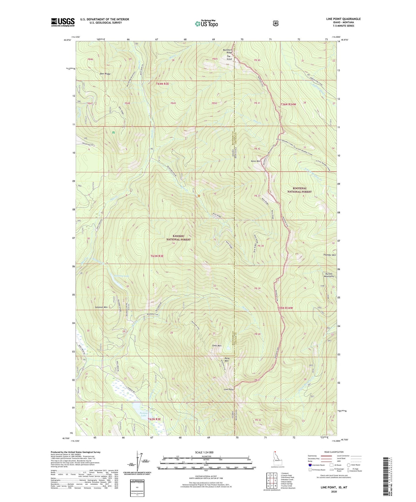
Line Point Idaho US Topo Map
Couldn't load pickup availability
Also explore the Line Point Forest Service Topo of this same quad for updated USFS data
2024 topographic map quadrangle Line Point in the states of Idaho, Montana. Scale: 1:24000. Based on the newly updated USGS 7.5' US Topo map series, this map is in the following counties: Boundary, Lincoln. The map contains contour data, water features, and other items you are used to seeing on USGS maps, but also has updated roads and other features. This is the next generation of topographic maps. Printed on high-quality waterproof paper with UV fade-resistant inks.
Quads adjacent to this one:
West: Meadow Creek
Northwest: Eastport
North: Canuck Peak
Northeast: Northwest Peak
East: Mount Baldy
Southeast: Newton Mountain
South: Curley Creek
Southwest: Moyie Springs
Contains the following named places: Buckhorn Mine, Buckhorn Ridge, Davis Creek, Deer Ridge, Deer Ridge Lookout, Faro Creek, Goat Mountain, Keno Creek, Keno Mountain, Line Point, Mill Creek, Perkins Lake, Reno Mountain, Solomon Creek, Solomon Lake, Solomon Mountain, The Scout, Thunder Mountain, ZIP Code: 83845