MyTopo
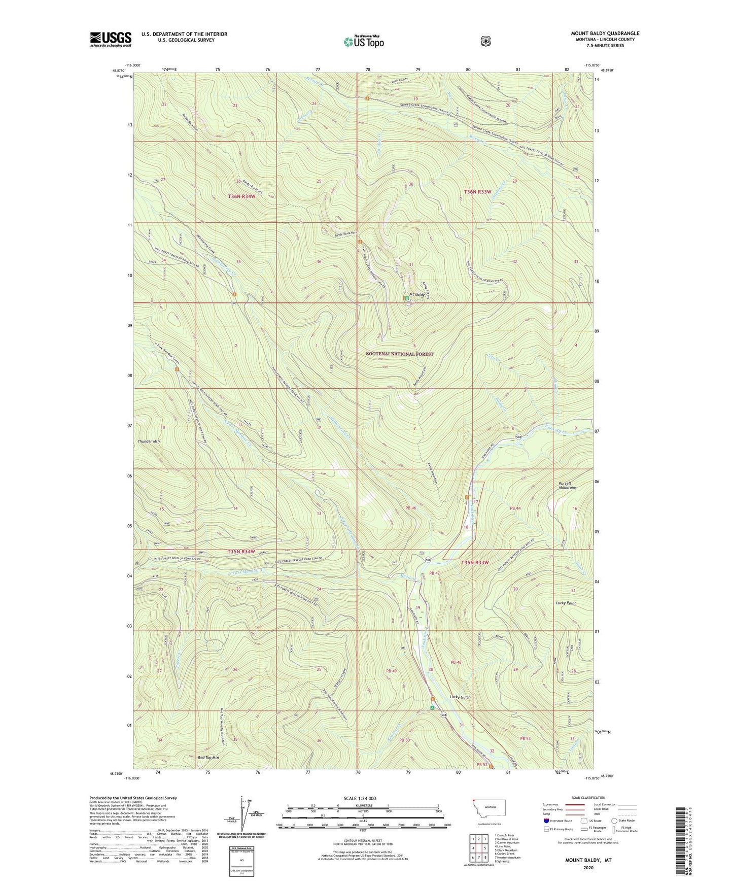
Mount Baldy Montana US Topo Map
Couldn't load pickup availability
Also explore the Mount Baldy Forest Service Topo of this same quad for updated USFS data
2024 topographic map quadrangle Mount Baldy in the state of Montana. Scale: 1:24000. Based on the newly updated USGS 7.5' US Topo map series, this map is in the following counties: Lincoln. The map contains contour data, water features, and other items you are used to seeing on USGS maps, but also has updated roads and other features. This is the next generation of topographic maps. Printed on high-quality waterproof paper with UV fade-resistant inks.
Quads adjacent to this one:
West: Line Point
Northwest: Canuck Peak
North: Northwest Peak
Northeast: Garver Mountain
East: Clark Mountain
Southeast: Sylvanite
South: Newton Mountain
Southwest: Curley Creek
This map covers the same area as the classic USGS quad with code o48115g8.
Contains the following named places: Baldy Creek, Blind Creek, Forest Creek, Green Creek, Hellroaring Creek, Large Creek, Lucky Gulch, Lucky Point, Meadow Creek, Mount Baldy, North Creek, North Fork Meadow Creek, Red Top Creek, Red Top Creek Campground, Red Top Mountain, Shine Creek, South Fork Meadow Creek, Sunday Creek, Sunshine Creek, Zero Creek