
MyTopo
Capeneys Lake Montana US Topo Map
Couldn't load pickup availability
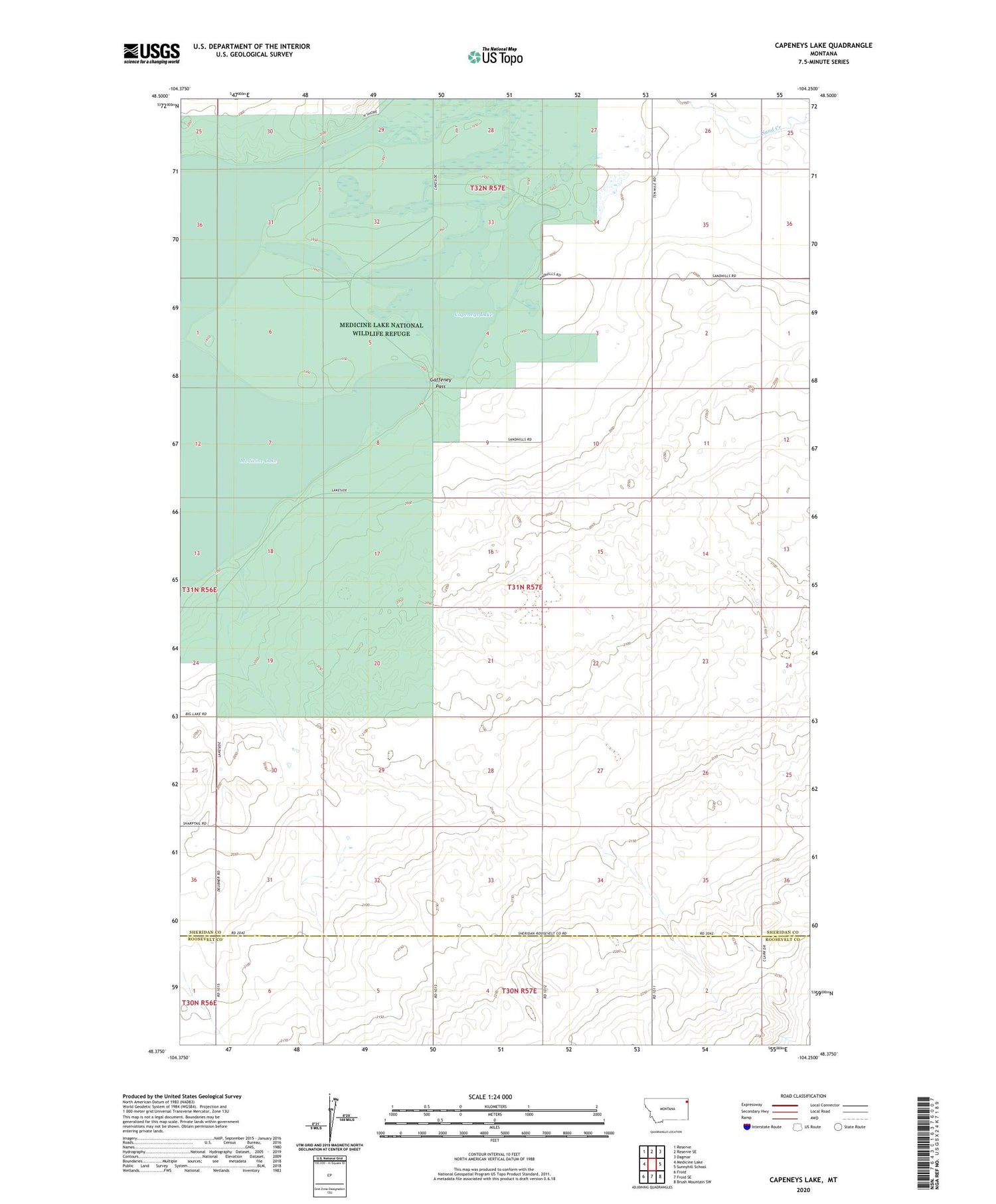
2020 topographic map quadrangle Capeneys Lake in the state of Montana. Scale: 1:24000. Based on the newly updated USGS 7.5' US Topo map series, this map is in the following counties: Sheridan, Roosevelt. The map contains contour data, water features, and other items you are used to seeing on USGS maps, but also has updated roads and other features. This is the next generation of topographic maps. Printed on high-quality waterproof paper with UV fade-resistant inks.
Quads adjacent to this one:
West: Medicine Lake
Northwest: Reserve
North: Reserve SE
Northeast: Dagmar
East: Sunnyhill School
Southeast: Brush Mountain SW
South: Froid SE
Southwest: Froid
Contains the following named places: 31N57E01BACA01 Well, 31N57E03DBBB01 Well, 31N57E09ABAD01 Well, 31N57E09CCBC01 Well, 31N57E17ABDC01 Well, 31N57E20ABDA01 Well, 31N57E28DCBC01 Well, 31N57E34CDDC01 Well, 32N57E26CBBB01 Well, 32N57E26CBBB02 Well, 32N57E26CBBB03 Well, Beverly School, Capeneys Lake, Dam Number 10, Gaffeney Pass, Hammond School, Rock Crossing


