MyTopo
Carbert Montana US Topo Map
Couldn't load pickup availability
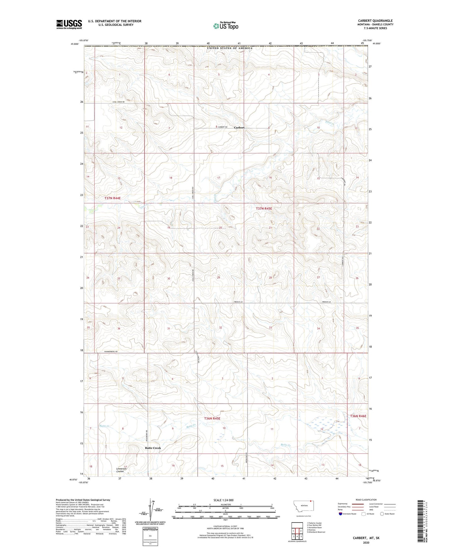
2024 topographic map quadrangle Carbert in the state of Montana. Scale: 1:24000. Based on the newly updated USGS 7.5' US Topo map series, this map is in the following counties: Daniels. The map contains contour data, water features, and other items you are used to seeing on USGS maps, but also has updated roads and other features. This is the next generation of topographic maps. Printed on high-quality waterproof paper with UV fade-resistant inks.
Quads adjacent to this one:
West: Flaherty Coulee
East: Four Buttes NW
Southeast: Killenbeck Reservoir
South: Peerless
Southwest: Horseshoe Basin
This map covers the same area as the classic USGS quad with code o48105h7.
Contains the following named places: 26N46E34ADDA01 Well, 36N45E03CDCB01 Well, 36N45E05DCCC01 Well, 36N45E08CCCA01 Well, 36N45E08CCCC01 Well, 36N45E08DDDD01 Well, 36N45E15BBCD01 Well, 37N44E01BCAA01 Well, 37N44E02DDAD01 Well, 37N44E13ACDC01 Well, 37N44E36DCDA01 Well, 37N45E03DCCC01 Well, 37N45E06DDAC01 Well, 37N45E07ADDA01 Well, 37N45E08ACDC01 Well, 37N45E09ACBD01 Well, 37N45E09ACDB01 Well, 37N45E09BCAD01 Well, 37N45E14BCCC01 Well, 37N45E19BADD01 Well, 37N45E19BADD02 Well, 37N45E19DCDB01 Well, 37N45E20BCCD01 Well, 37N45E23CCC_01 Well, 37N45E27DCCD01 Well, 37N45E28CDCA01 Well, 37N45E29DDAC01 Well, 37N45E31BDAD01 Well, 37N45E33CBBD01 Well, Butte Creek, Butte Creek School, Carbert, Carbert Post Office, Carbert School, Coalcreek Post Office, Lewarton Coulee