MyTopo
Four Buttes NW Montana US Topo Map
Couldn't load pickup availability
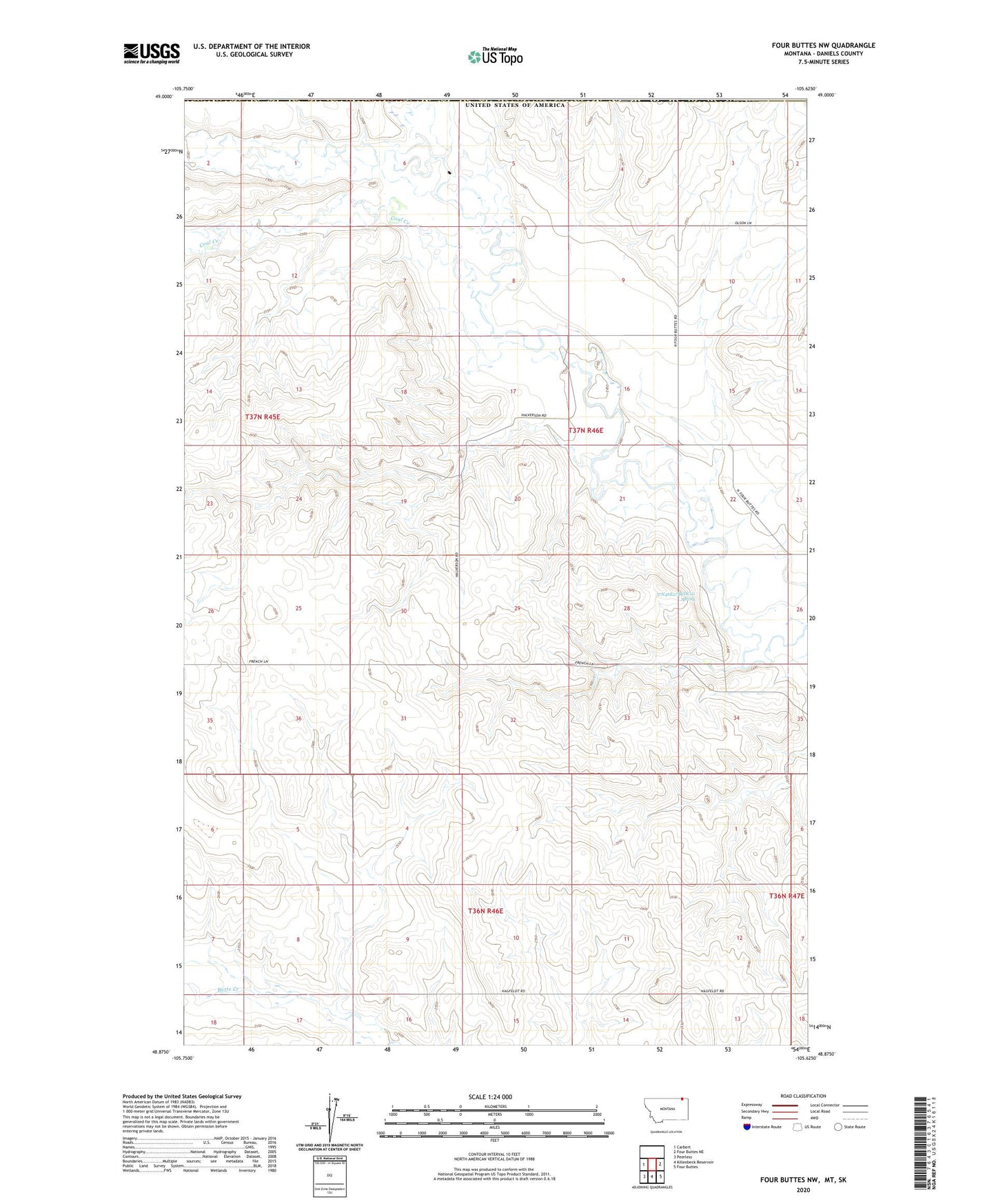
2024 topographic map quadrangle Four Buttes NW in the state of Montana. Scale: 1:24000. Based on the newly updated USGS 7.5' US Topo map series, this map is in the following counties: Daniels. The map contains contour data, water features, and other items you are used to seeing on USGS maps, but also has updated roads and other features. This is the next generation of topographic maps. Printed on high-quality waterproof paper with UV fade-resistant inks.
Quads adjacent to this one:
West: Carbert
East: Four Buttes NE
Southeast: Four Buttes
South: Killenbeck Reservoir
Southwest: Peerless
This map covers the same area as the classic USGS quad with code o48105h6.
Contains the following named places: 37N45E25ACCC01 Well, 37N45E35AAAD01 Well, 37N45E36BBBC01 Well, 37N46E08DDCA01 Well, 37N46E08DDCA02 Well, 37N46E08DDCA03 Well, 37N46E19BADB01 Well, 37N46E19BADD01 Well, 37N46E22ADCA01 Well, 37N46E22ADCD01 Well, 37N46E27BCAB01 Well, 37N46E27BCAD01 Well, 37N46E27BCDC01 Spring, Coal Creek, Goose Creek, Lost Child Creek