MyTopo
Carney Montana US Topo Map
Couldn't load pickup availability
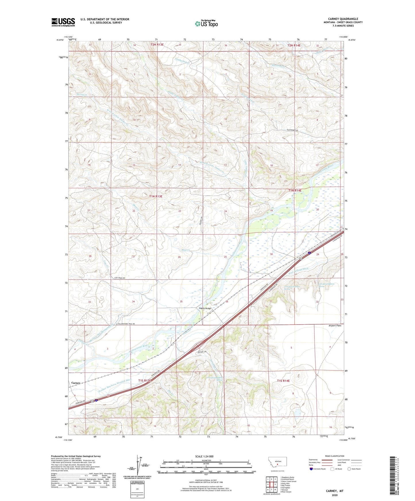
2020 topographic map quadrangle Carney in the state of Montana. Scale: 1:24000. Based on the newly updated USGS 7.5' US Topo map series, this map is in the following counties: Sweet Grass. The map contains contour data, water features, and other items you are used to seeing on USGS maps, but also has updated roads and other features. This is the next generation of topographic maps. Printed on high-quality waterproof paper with UV fade-resistant inks.
Quads adjacent to this one:
West: Kelly Hills
Northwest: Raspberry Butte
North: Grosfield Ranch
Northeast: Otter Creek School
East: Big Timber
Southeast: Ross Canyon
South: McLeod
Southwest: Springdale
Contains the following named places: 01N13E25DDBA01 Well, 01N13E36CBAC01 Well, 01N14E30CBBD01 Well, 01N14E31ADBA01 Spring, 01N14E32ABCC01 Spring, 01S13E12AADD01 Spring, Airport Flats, Antelope Creek, Beley Ditch, Beley Ranch, Bridge School, Carney, Carney School, Cow Creek, Dehart, Dry Creek, Grey Bear Fishing Access Site, Little Timber Creek, Oxbow Creek, Prather Mayborn Westfall Ditch, Shed Creek, Spring Creek, Vogues Bridge, West Fork Little Timber Creek, Yost Ranch