MyTopo
Otter Creek School Montana US Topo Map
Couldn't load pickup availability
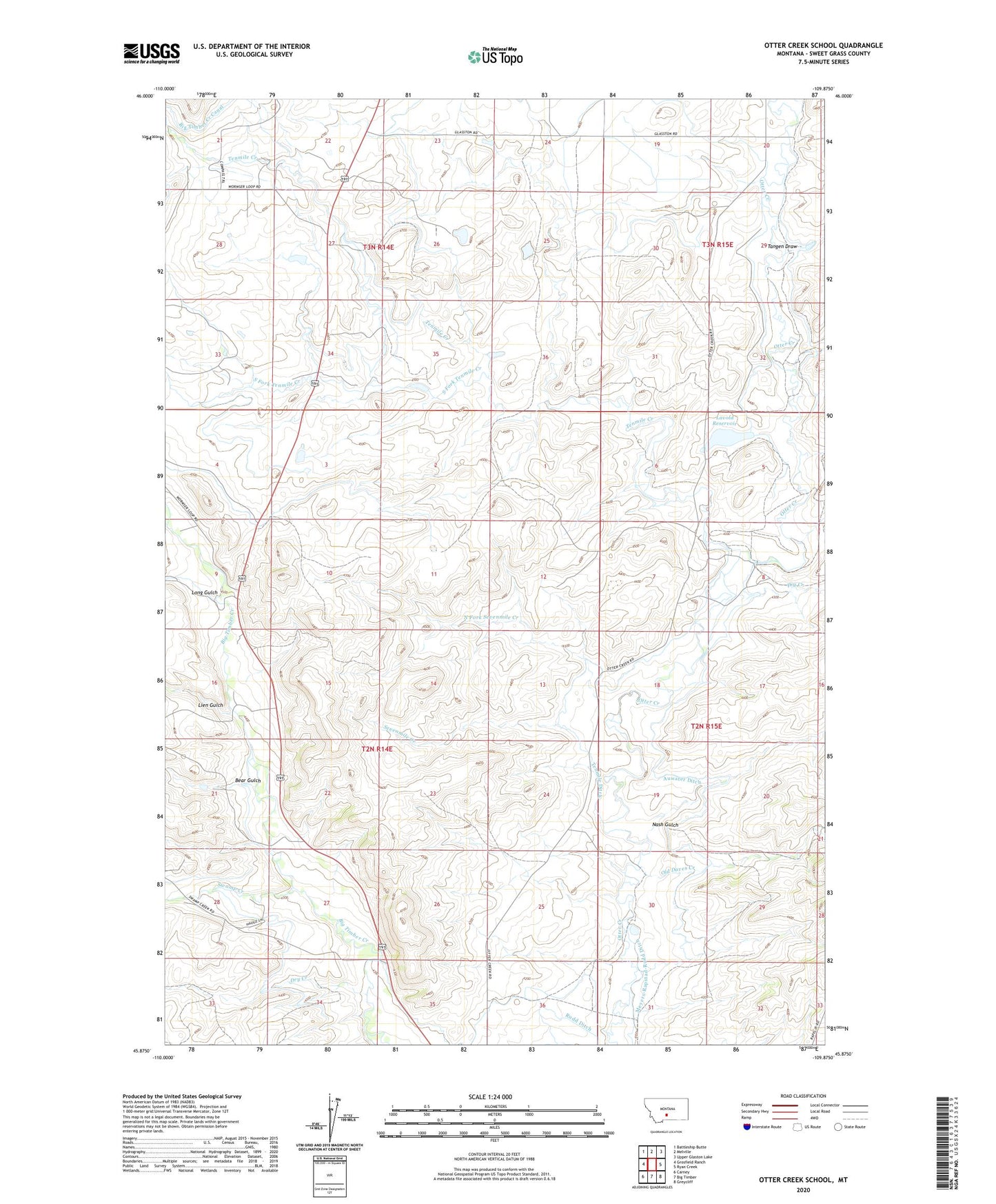
2024 topographic map quadrangle Otter Creek School in the state of Montana. Scale: 1:24000. Based on the newly updated USGS 7.5' US Topo map series, this map is in the following counties: Sweet Grass. The map contains contour data, water features, and other items you are used to seeing on USGS maps, but also has updated roads and other features. This is the next generation of topographic maps. Printed on high-quality waterproof paper with UV fade-resistant inks.
Quads adjacent to this one:
West: Grosfield Ranch
Northwest: Battleship Butte
North: Melville
Northeast: Upper Glaston Lake
East: Ryan Creek
Southeast: Greycliff
South: Big Timber
Southwest: Carney
This map covers the same area as the classic USGS quad with code o45109h8.
Contains the following named places: 01N14E15DAAB01 Well, 02N14E15____01 Well, 02N14E15CBCA01 Well, 02N14E16____01 Well, 02N14E22____01 Well, 02N14E22C___01 Well, 02N14E34A___01 Well, 02N15E05D___01 Well, 02N15E06____01 Well, 02N15E08CAAC01 Well, 02N15E18____01 Well, 03N14E24____01 Well, 59011, Auwater Ditch, Bear Gulch, Big Timber Creek Canal, Bjorndal Ranch, Branae Ranch, Cain Dam, Cosgriff Ranch, D McCormick Ranch, Dry Creek, Ellison Ranch, Glasston School, Huyser Ranch, J McCormick Ranch, Kortum Ranch, Kremper Ranch, Lavold Dam, Lavold Ranch, Lavold Reservoir, Lien Gulch, Lien Ranch, Long Gulch, Mattice Homestead, Murray Ranch, Nash Gulch, Nelson Ranch, North Fork Sevenmile Creek, North of the Yellowstone Division, Old Daves Creek, Otter Creek School, Papez Number 1 Dam, Papez Number 2 Dam, Sevenmile Creek, Sherod Ranch, Smoky Dam, Songstad Ranch, South Fork Tenmile Creek, Swamp Creek, Tangen Draw, Tenmile Creek, Tenmile Ditch, Wild Rose School