MyTopo
Chamberlain Mountain Montana US Topo Map
Couldn't load pickup availability
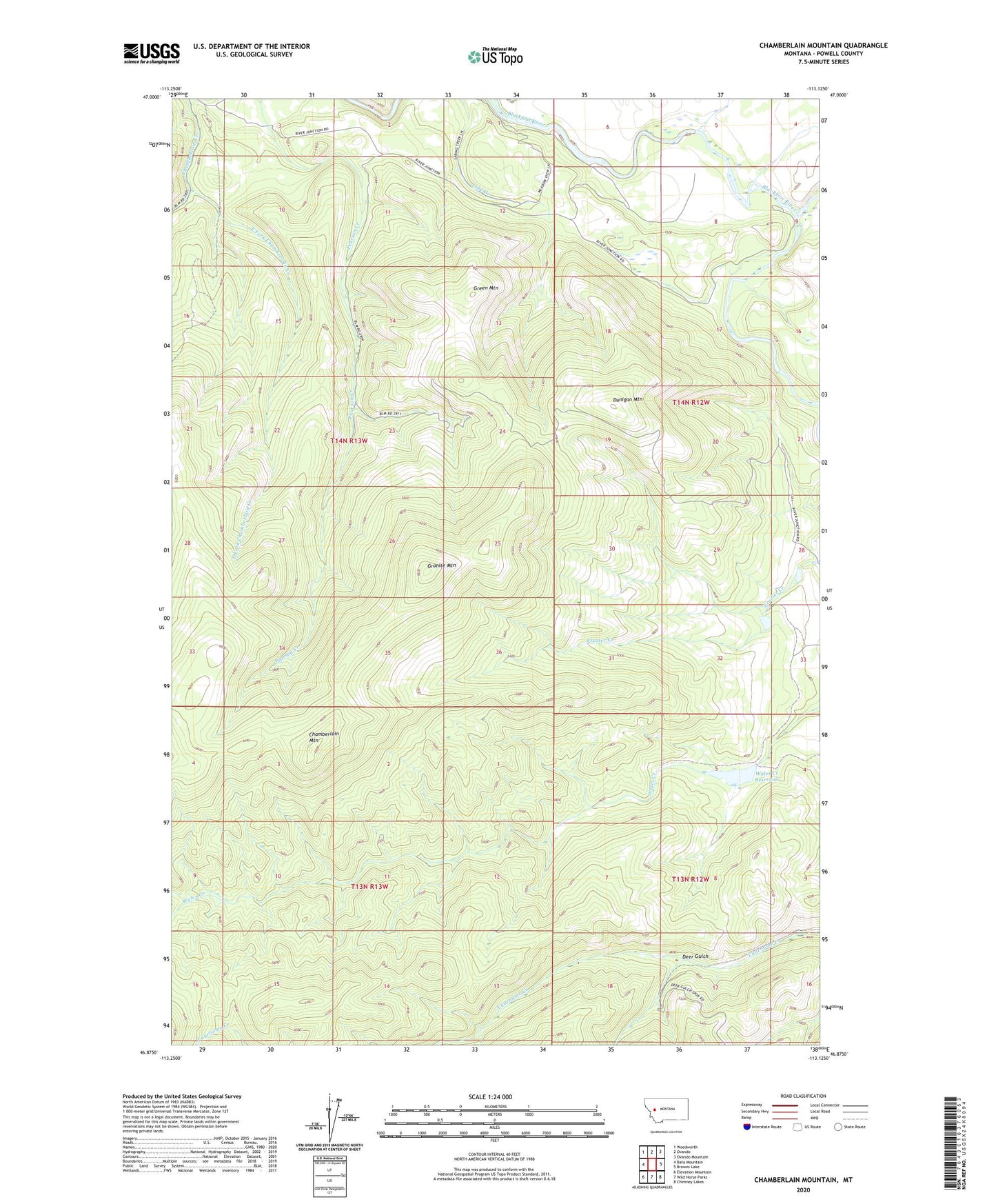
2020 topographic map quadrangle Chamberlain Mountain in the state of Montana. Scale: 1:24000. Based on the newly updated USGS 7.5' US Topo map series, this map is in the following counties: Powell. The map contains contour data, water features, and other items you are used to seeing on USGS maps, but also has updated roads and other features. This is the next generation of topographic maps. Printed on high-quality waterproof paper with UV fade-resistant inks.
Quads adjacent to this one:
West: Bata Mountain
Northwest: Woodworth
North: Ovando
Northeast: Ovando Mountain
East: Browns Lake
Southeast: Chimney Lakes
South: Wild Horse Parks
Southwest: Elevation Mountain
Contains the following named places: Chamberlain Mountain, Deer Gulch, Dunigan Mountain, East Fork Chamberlain Creek, Granite Mountain, Green Mountain, North Fork Blackfoot River, Raymond Dam, Raymond Number 2 Dam, Raymond Number 3 Dam, River Junction Fishing Access Site, Wales Creek Reservoir, Wales Creek Reservoir Dam