MyTopo
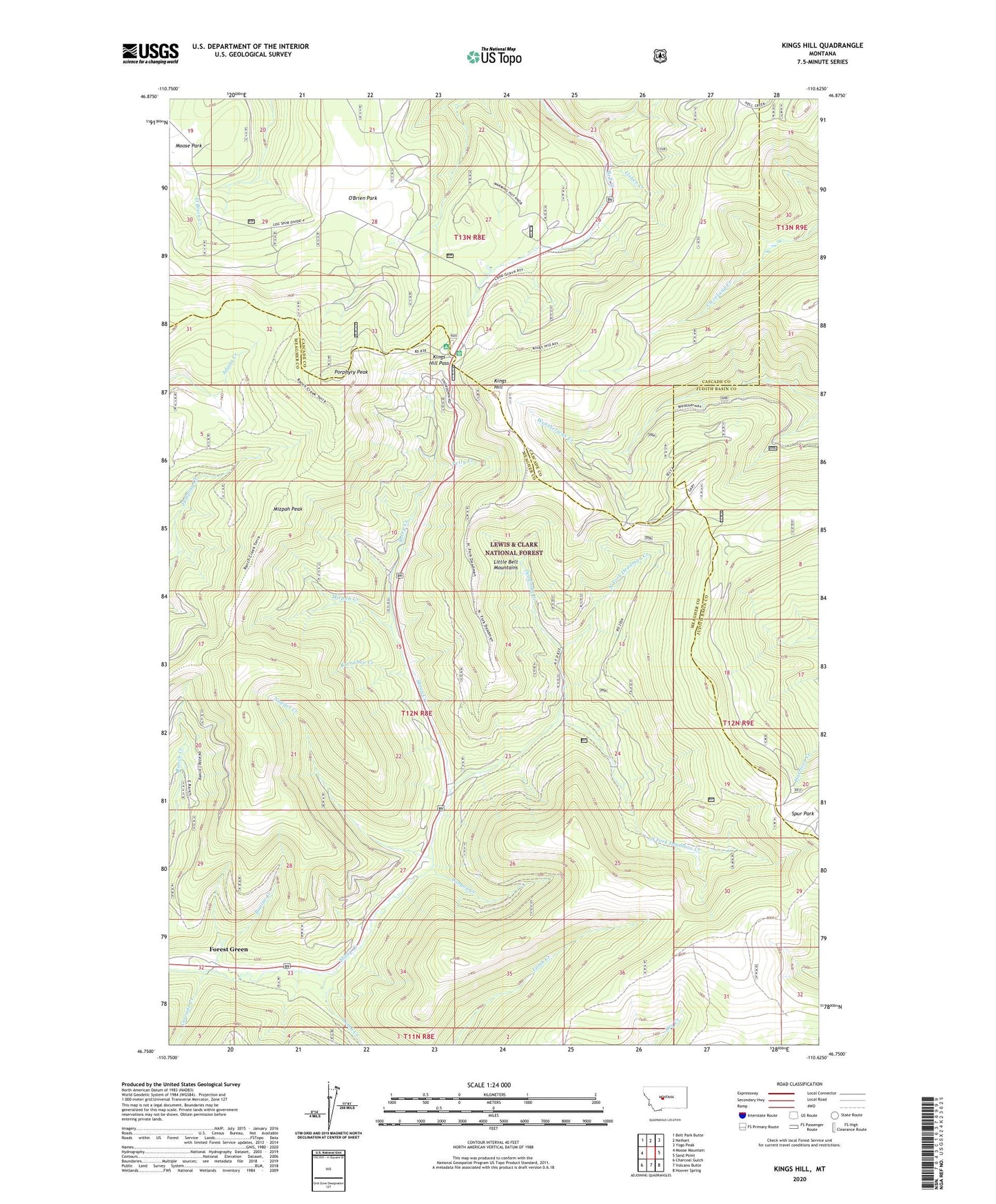
Kings Hill Montana US Topo Map
Couldn't load pickup availability
Also explore the Kings Hill Forest Service Topo of this same quad for updated USFS data
2024 topographic map quadrangle Kings Hill in the state of Montana. Scale: 1:24000. Based on the newly updated USGS 7.5' US Topo map series, this map is in the following counties: Meagher, Cascade, Judith Basin. The map contains contour data, water features, and other items you are used to seeing on USGS maps, but also has updated roads and other features. This is the next generation of topographic maps. Printed on high-quality waterproof paper with UV fade-resistant inks.
Quads adjacent to this one:
West: Moose Mountain
Northwest: Belt Park Butte
North: Neihart
Northeast: Yogo Peak
East: Sand Point
Southeast: Hoover Spring
South: Volcano Butte
Southwest: Charcoal Gulch
This map covers the same area as the classic USGS quad with code o46110g6.
Contains the following named places: Arkansas Traveller Ski Trail, Barnaboo Creek, Big Seven Ski Trail, Black Diamond Ski Trail, Bonine Creek, Brown-eyed Queen Ski Trail, Canyon Creek, Cascade Creek, Compromise Pass Ski Trail, Cumberland Ski Trail, Deadman Creek, Dynamite Ski Trail, Forest Green, Frisco Ski Trail, Galen Post Office, Geronimo Ski Trail, Glory Hole Ski Trail, Golden Goose Ski Trail, Good Luck Ski Trail, Gun Barrel Ski Trail, James Bond Ski Trail, King Hill Winter Sports Area, Kings Hill, Kings Hill Campground, Kings Hill Guard Station, Kings Hill Pass, Kings Hill Quarry, Lamb Creek, Lamb Creek Campground, Last Chance Gulch Ski Trail, Lewis and Clark National Forest, Lishen Creek, Mizpah Creek, Mizpah Peak, Mizpah Race Hill Ski Trail, Mizpah Ski Trail, Moly Ski Trail, Muley Ski Trail, North Fork Deadman Creek, Nugget Creek, O'Brien Park, Pan Handle Ski Trail, Pay Dirt Ski Trail, Petty Creek, Porphyry Peak, Porphyry Peak Lookout, Prentice Ski Trail, Quicksilver Lower Ski Trail, Quicksilver Upper Ski Trail, Ripley Lower Ski Trail, Ripley Upper Ski Trail, Ruby Gulch Ski Trail, Ruby Ski Trail, Second Thought Ski Trail, Silverhorn Ski Trail, Sluice Box Ski Trail, Sour Dough Hill Ski Trail, South Fork Deadman Creek, Speculation Ski Trail, Thale Post Office, Yogo Ski Trail