MyTopo
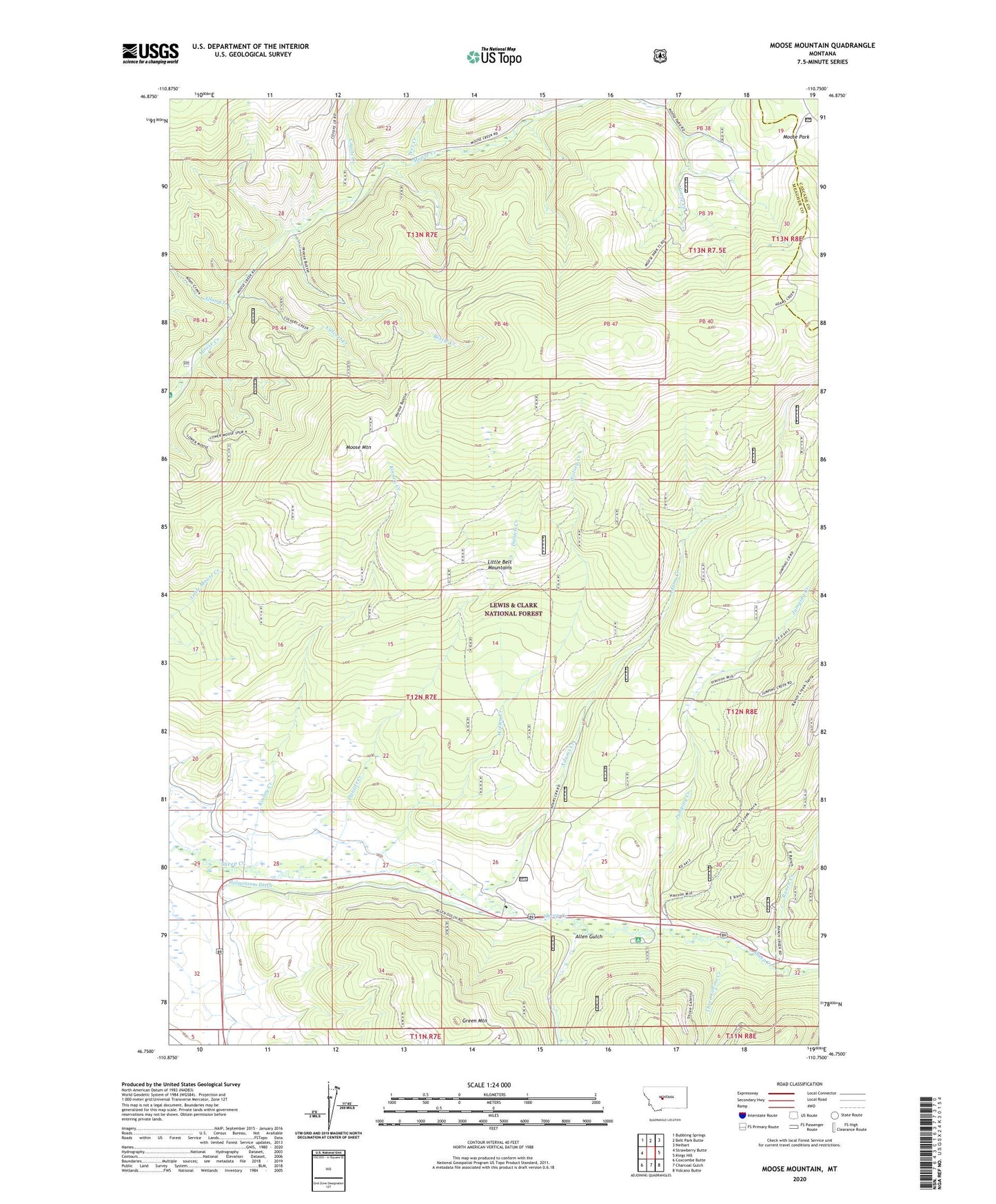
Moose Mountain Montana US Topo Map
Couldn't load pickup availability
Also explore the Moose Mountain Forest Service Topo of this same quad for updated USFS data
2024 topographic map quadrangle Moose Mountain in the state of Montana. Scale: 1:24000. Based on the newly updated USGS 7.5' US Topo map series, this map is in the following counties: Meagher, Cascade. The map contains contour data, water features, and other items you are used to seeing on USGS maps, but also has updated roads and other features. This is the next generation of topographic maps. Printed on high-quality waterproof paper with UV fade-resistant inks.
Quads adjacent to this one:
West: Strawberry Butte
Northwest: Bubbling Springs
North: Belt Park Butte
Northeast: Neihart
East: Kings Hill
Southeast: Volcano Butte
South: Charcoal Gulch
Southwest: Coxcombe Butte
This map covers the same area as the classic USGS quad with code o46110g7.
Contains the following named places: Adams Creek, Allan Creek, Allen Gulch, Barzee Post Office, Barzee School, Bottle Creek, Cook Ranch, Coyote Creek, Culvert Creek, Daniels Creek, Green Mountain, Holmstrom Ditch, Jumping Creek, Jumping Creek Campground, Kinney Creek, Moose Creek Campground, Moose Mountain, Moose Park, Ranch Creek, SW SW Section 28 Mine, Three Cabins Creek, Wet Creek, Wolsey, Wolsey Creek, Wolsey Post Office, Woolsey School