MyTopo
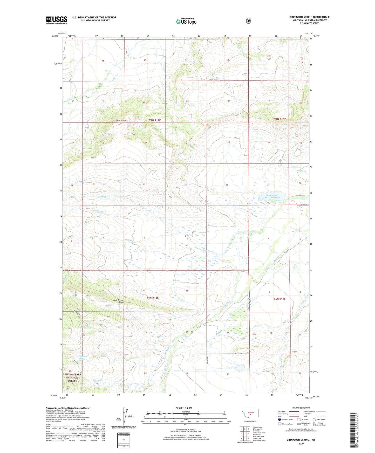
Cinnamon Spring Montana US Topo Map
Couldn't load pickup availability
Also explore the Cinnamon Spring Forest Service Topo of this same quad for updated USFS data
2024 topographic map quadrangle Cinnamon Spring in the state of Montana. Scale: 1:24000. Based on the newly updated USGS 7.5' US Topo map series, this map is in the following counties: Wheatland. The map contains contour data, water features, and other items you are used to seeing on USGS maps, but also has updated roads and other features. This is the next generation of topographic maps. Printed on high-quality waterproof paper with UV fade-resistant inks.
Quads adjacent to this one:
West: Cinnamon Peak
Northwest: Martinsdale
North: Twodot NW
Northeast: Twodot
East: Lebo Lake
Southeast: Porcupine Butte
South: Rein Lake
Southwest: Loco Mountain
This map covers the same area as the classic USGS quad with code o46110c2.
Contains the following named places: 06N13E05C___01 Well, 59085, Big Elk Dam, Buzzard Creek, Cinnamon Creek, Cinnamon Spring, Coffin Butte, Jack Arthur Ridge, Martin and C Bar J Reservoir, McFarland-White Ranch, Spring Creek, Station Creek, Top Hat Ranch, White Elk Dam, Willow Creek