MyTopo
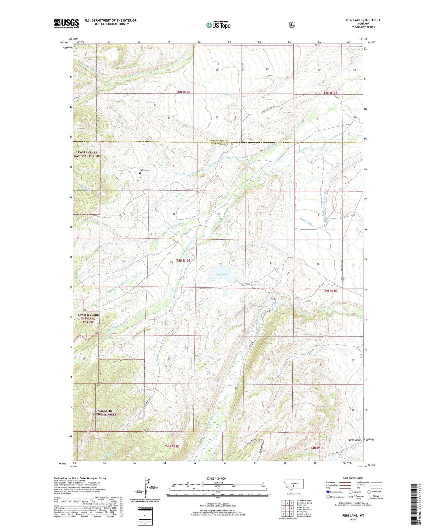
Rein Lake Montana US Topo Map
Couldn't load pickup availability
Also explore the Rein Lake Forest Service Topo of this same quad for updated USFS data
2024 topographic map quadrangle Rein Lake in the state of Montana. Scale: 1:24000. Based on the newly updated USGS 7.5' US Topo map series, this map is in the following counties: Sweet Grass, Wheatland. The map contains contour data, water features, and other items you are used to seeing on USGS maps, but also has updated roads and other features. This is the next generation of topographic maps. Printed on high-quality waterproof paper with UV fade-resistant inks.
Quads adjacent to this one:
West: Loco Mountain
Northwest: Cinnamon Peak
North: Cinnamon Spring
Northeast: Lebo Lake
East: Porcupine Butte
Southeast: Battleship Butte
South: Amelong Creek
Southwest: Crazy Peak
This map covers the same area as the classic USGS quad with code o46110b2.
Contains the following named places: 06N12E25ADAD01 Well, American Fork Ranch, American Fork Ranch Ditch, Anchor Ranch, Blackaby Creek, Hopkins Cemetery, Makey Creek, Middle Fork American Fork, North Fork American Fork, North Fork Big Elk Creek, O'Hearn Creek, Rein Lake, Ryan-Tronrud Dam, South Fork American Fork, Spring Creek, Wallis Post Office