MyTopo
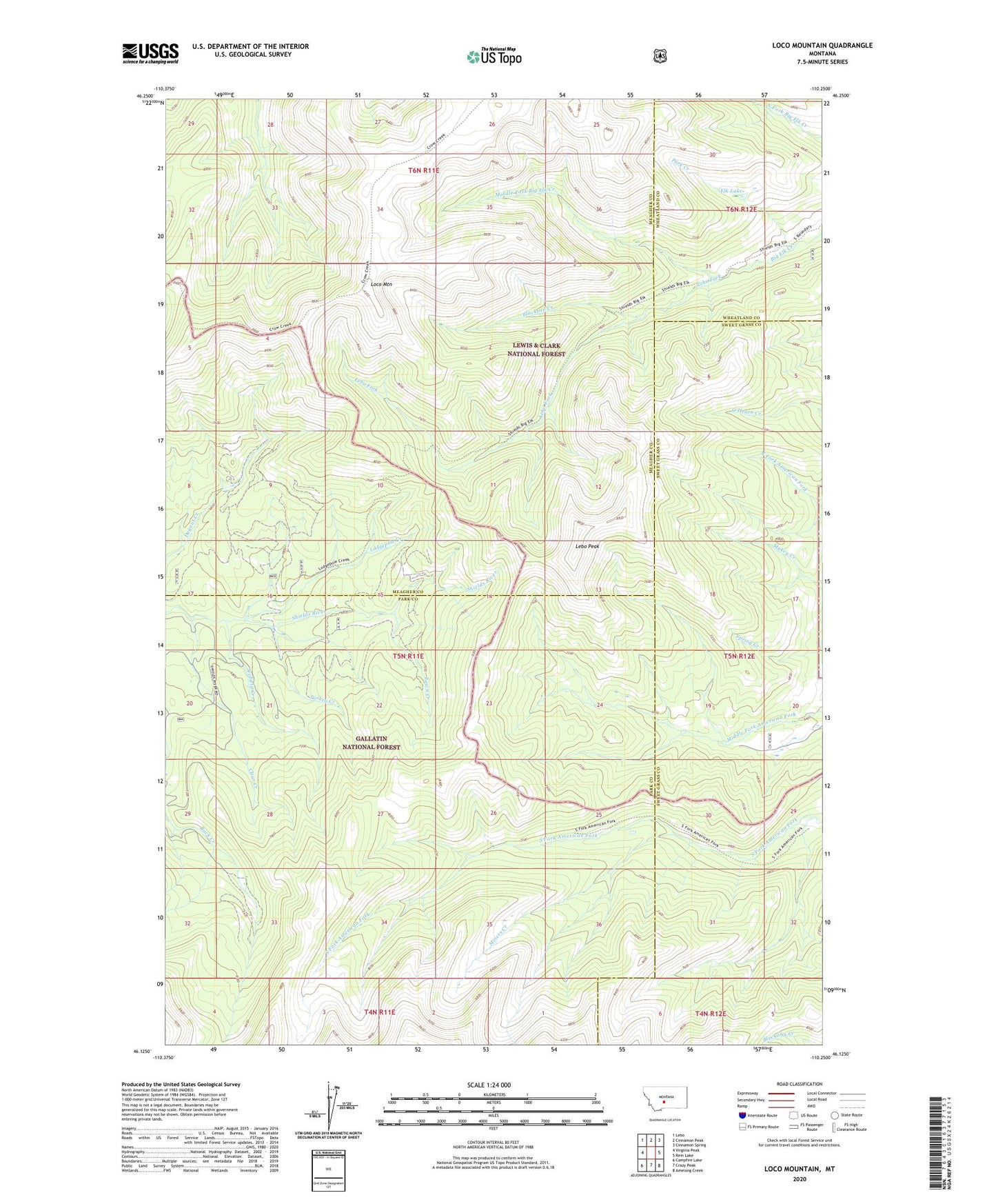
Loco Mountain Montana US Topo Map
Couldn't load pickup availability
Also explore the Loco Mountain Forest Service Topo of this same quad for updated USFS data
2024 topographic map quadrangle Loco Mountain in the state of Montana. Scale: 1:24000. Based on the newly updated USGS 7.5' US Topo map series, this map is in the following counties: Meagher, Park, Sweet Grass, Wheatland. The map contains contour data, water features, and other items you are used to seeing on USGS maps, but also has updated roads and other features. This is the next generation of topographic maps. Printed on high-quality waterproof paper with UV fade-resistant inks.
Quads adjacent to this one:
West: Virginia Peak
Northwest: Lebo
North: Cinnamon Peak
Northeast: Cinnamon Spring
East: Rein Lake
Southeast: Amelong Creek
South: Crazy Peak
Southwest: Campfire Lake
This map covers the same area as the classic USGS quad with code o46110b3.
Contains the following named places: Blacktail Creek, Clear Creek, Elk Lake, Fawn Creek, Lebo Fork, Lebo Peak, Loco Mountain, Lodgepole Creek, Middle Fork Big Elk Creek, Miners Creek, Park Creek, Scofield Creek, Turkey Creek