
MyTopo
Circle Bridge Montana US Topo Map
Couldn't load pickup availability
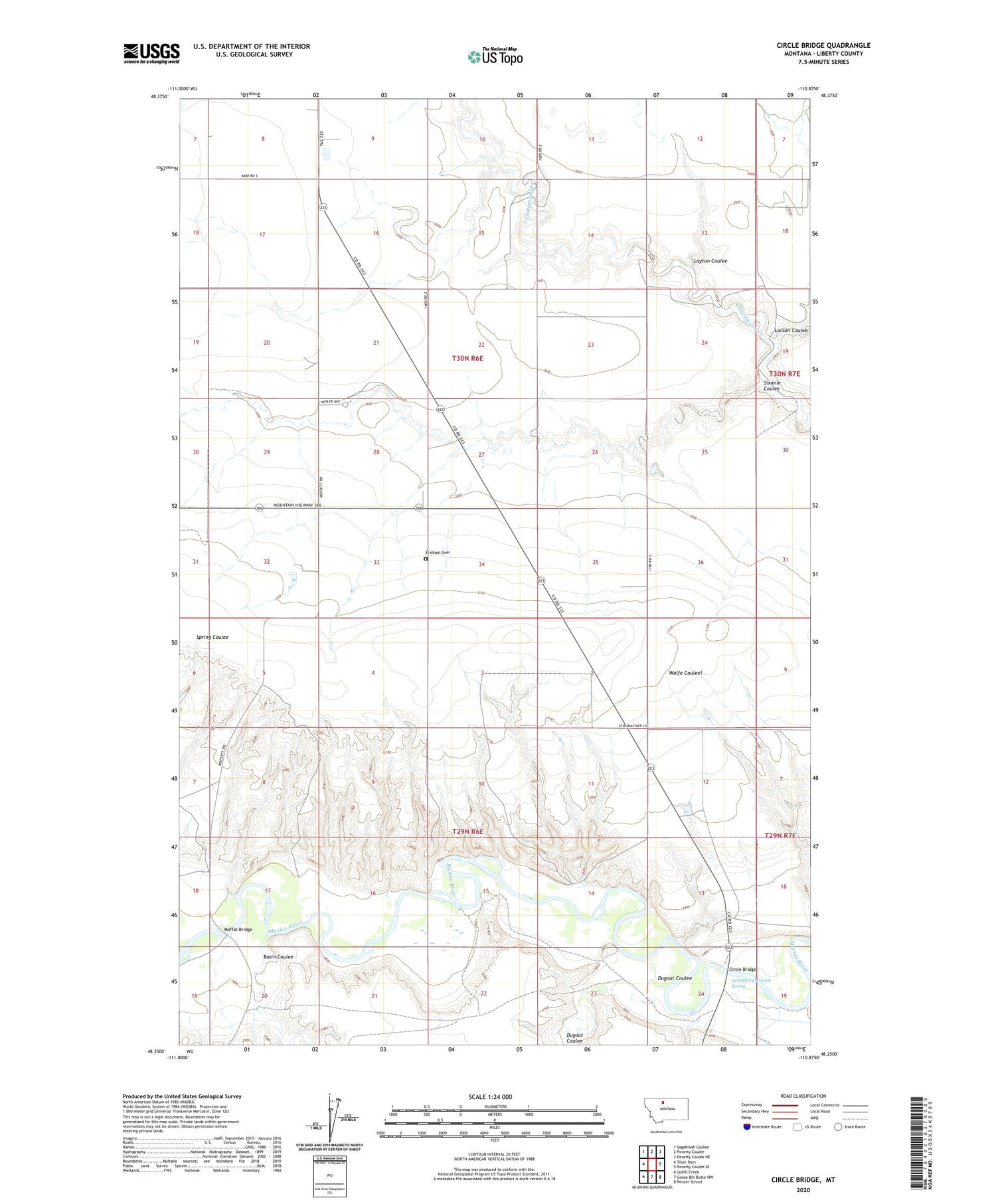
2020 topographic map quadrangle Circle Bridge in the state of Montana. Scale: 1:24000. Based on the newly updated USGS 7.5' US Topo map series, this map is in the following counties: Liberty. The map contains contour data, water features, and other items you are used to seeing on USGS maps, but also has updated roads and other features. This is the next generation of topographic maps. Printed on high-quality waterproof paper with UV fade-resistant inks.
Quads adjacent to this one:
West: Tiber Dam
Northwest: Sagebrush Coulee
North: Poverty Coulee
Northeast: Poverty Coulee NE
East: Poverty Coulee SE
Southeast: Penzer School
South: Goose Bill Butte NW
Southwest: Uphill Creek
Contains the following named places: 29N06E24ACAD01 Spring, 30N07E30BCBD01 Well, Basin Coulee, Circle Bridge, Dugout Coulee, Erickson Cemetery, George, George Post Office, Larson Coulee, Layton Coulee, Moffat Bridge, Sixmile Coulee


