MyTopo
Poverty Coulee Montana US Topo Map
Couldn't load pickup availability
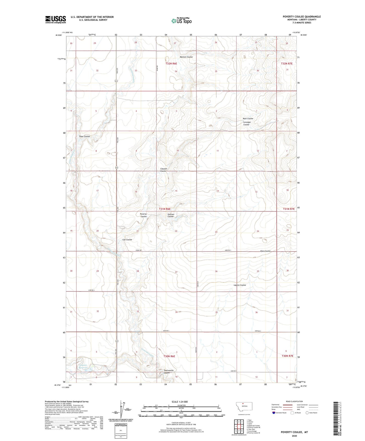
2024 topographic map quadrangle Poverty Coulee in the state of Montana. Scale: 1:24000. Based on the newly updated USGS 7.5' US Topo map series, this map is in the following counties: Liberty. The map contains contour data, water features, and other items you are used to seeing on USGS maps, but also has updated roads and other features. This is the next generation of topographic maps. Printed on high-quality waterproof paper with UV fade-resistant inks.
Quads adjacent to this one:
West: Sagebrush Coulee
Northwest: Tiber
North: Chester
Northeast: Joplin
East: Poverty Coulee NE
Southeast: Poverty Coulee SE
South: Circle Bridge
Southwest: Tiber Dam
This map covers the same area as the classic USGS quad with code o48110d8.
Contains the following named places: 30N06E11BBBA01 Well, 31N06E27ADDD01 Well, 31N06E35BAAC01 Well, Clausen Coulee, Cox Coulee, Gagnon Reservoir, Loranger Coulee, Manton Coulee, Nutt Coulee, Poverty Coulee, Stellner Coulee, Tiber Coulee, Twelvemile Coulee