MyTopo
Cleveland Montana US Topo Map
Couldn't load pickup availability
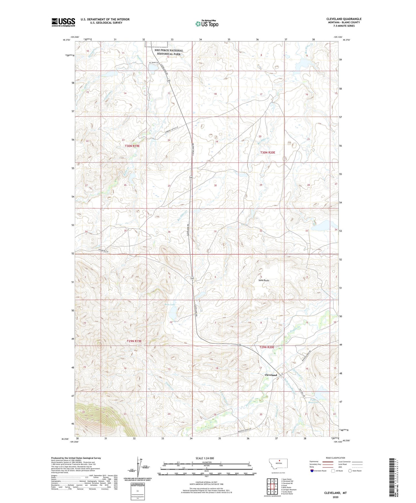
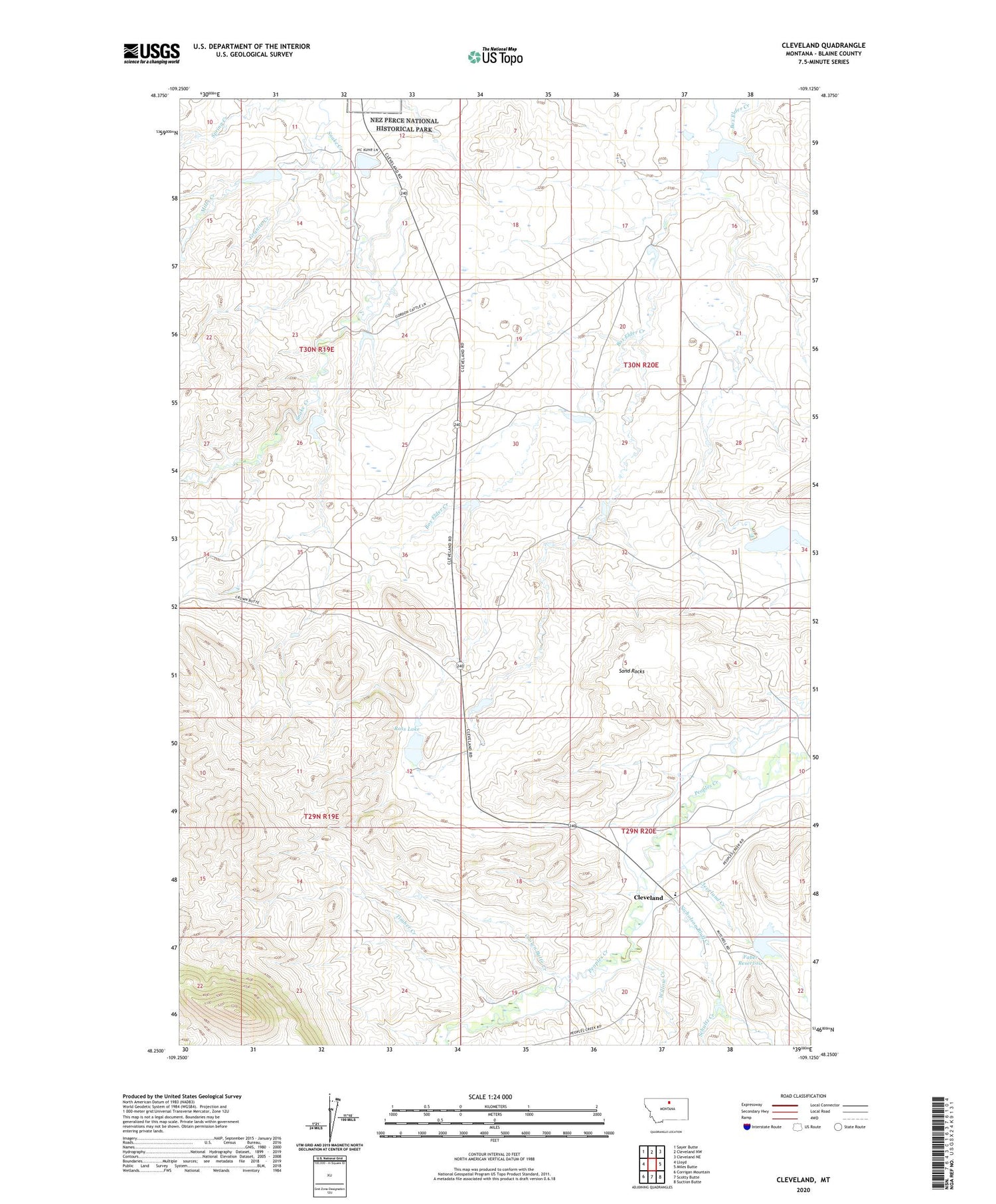
2020 topographic map quadrangle Cleveland in the state of Montana. Scale: 1:24000. Based on the newly updated USGS 7.5' US Topo map series, this map is in the following counties: Blaine. The map contains contour data, water features, and other items you are used to seeing on USGS maps, but also has updated roads and other features. This is the next generation of topographic maps. Printed on high-quality waterproof paper with UV fade-resistant inks.
Quads adjacent to this one:
West: Lloyd
Northwest: Sayer Butte
North: Cleveland NW
Northeast: Cleveland NE
East: Miles Butte
Southeast: Suction Butte
South: Scotty Butte
Southwest: Corrigan Mountain
Contains the following named places: Big Bear Dam, Chinook Division, Cleveland, Cleveland Creek, Cleveland Post Office, Cleveland School, Crown Butte, Crown Butte Creek, Faber Cattle Dam, Faber Reservoir, Faber Reservoir Fishing Access Site, Gordon Cattle Company Number 1 Dam, Gordon Cattle Company Number 2 Dam, Granite Creek, Heaven Dam, Miles Creek, Nelson Post Office, Nicholson Bluff Creek, Number 6 Dam, Oak Dam, Ross Lake, Sand Rocks, Schultz Creek, Sugar Dam, Timber Butte, Timber Creek, Willow Creek