MyTopo
Cleveland NW Montana US Topo Map
Couldn't load pickup availability
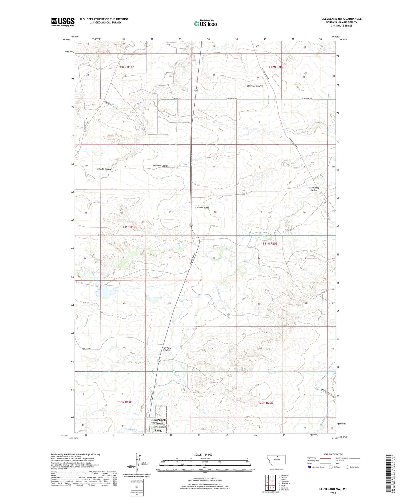
2024 topographic map quadrangle Cleveland NW in the state of Montana. Scale: 1:24000. Based on the newly updated USGS 7.5' US Topo map series, this map is in the following counties: Blaine. The map contains contour data, water features, and other items you are used to seeing on USGS maps, but also has updated roads and other features. This is the next generation of topographic maps. Printed on high-quality waterproof paper with UV fade-resistant inks.
Quads adjacent to this one:
West: Sayer Butte
Northwest: Lohman SE
North: Chinook
Northeast: Zurich
East: Cleveland NE
Southeast: Miles Butte
South: Cleveland
Southwest: Lloyd
This map covers the same area as the classic USGS quad with code o48109d2.
Contains the following named places: 31N19E13ADBA01 Well, 31N19E13ADBA02 Well, 31N20E28CDBD01 Well, 32N19E36CDCA01 Well, 32N19E36CDCB01 Well, 32N20E32DDDC01 Well, 32N20E33DDAD01 Well, 32N20E34CCBB01 Well, Bean Creek, Bear Paw Battlefield - Nez Perce National Historical Park, Blackjack Mine, Bowes Oil Field, Central School, Chief Joseph Battleground, Garden Dam, New Hope School, Olson Road Coulee, Red Rock School, Snake Dam, Spring Coulee, Spring Creek, Tiger Number 1 Dam