MyTopo
Scotty Butte Montana US Topo Map
Couldn't load pickup availability
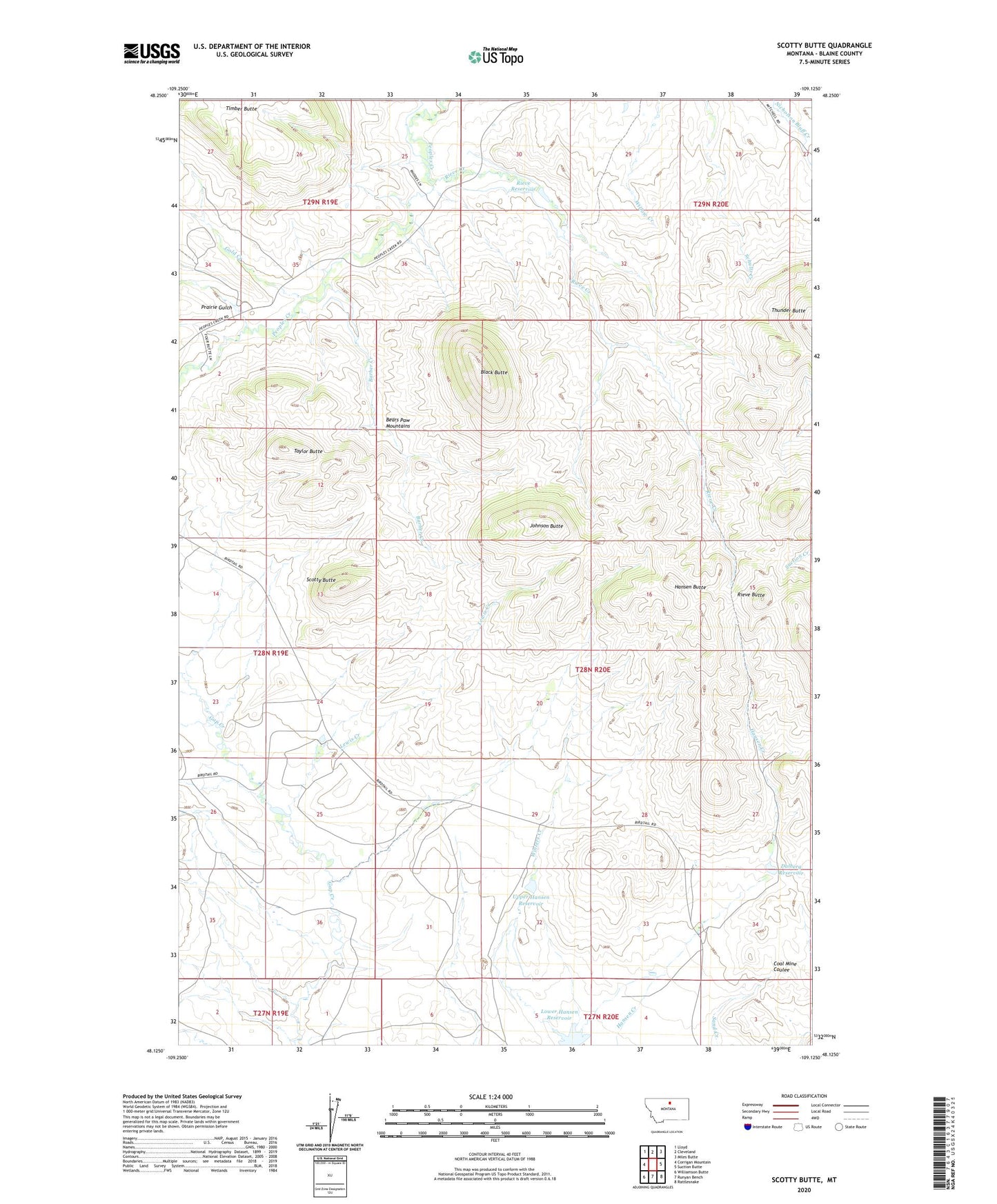
2024 topographic map quadrangle Scotty Butte in the state of Montana. Scale: 1:24000. Based on the newly updated USGS 7.5' US Topo map series, this map is in the following counties: Blaine. The map contains contour data, water features, and other items you are used to seeing on USGS maps, but also has updated roads and other features. This is the next generation of topographic maps. Printed on high-quality waterproof paper with UV fade-resistant inks.
Quads adjacent to this one:
West: Corrigan Mountain
Northwest: Lloyd
North: Cleveland
Northeast: Miles Butte
East: Suction Butte
Southeast: Rattlesnake
South: Runyan Bench
Southwest: Williamson Butte
This map covers the same area as the classic USGS quad with code o48109b2.
Contains the following named places: Barber Creek, Black Butte, Dalberg Reservoir, General AG Corporation Number 1 Dam, Gold Creek, Hansen Butte, Johnson Butte, Lewis Creek, Lower Hansen Reservoir, Number 10 Dam, Prairie Gulch, Rieve Butte, Rieve Creek, Rieve Reservoir, Scotty Butte, Taylor Butte, Upper Hansen Reservoir