MyTopo
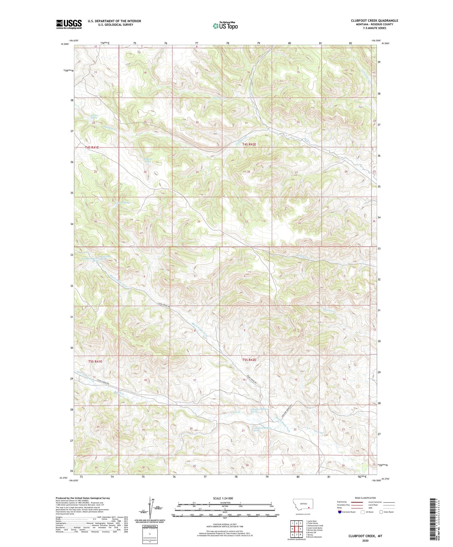
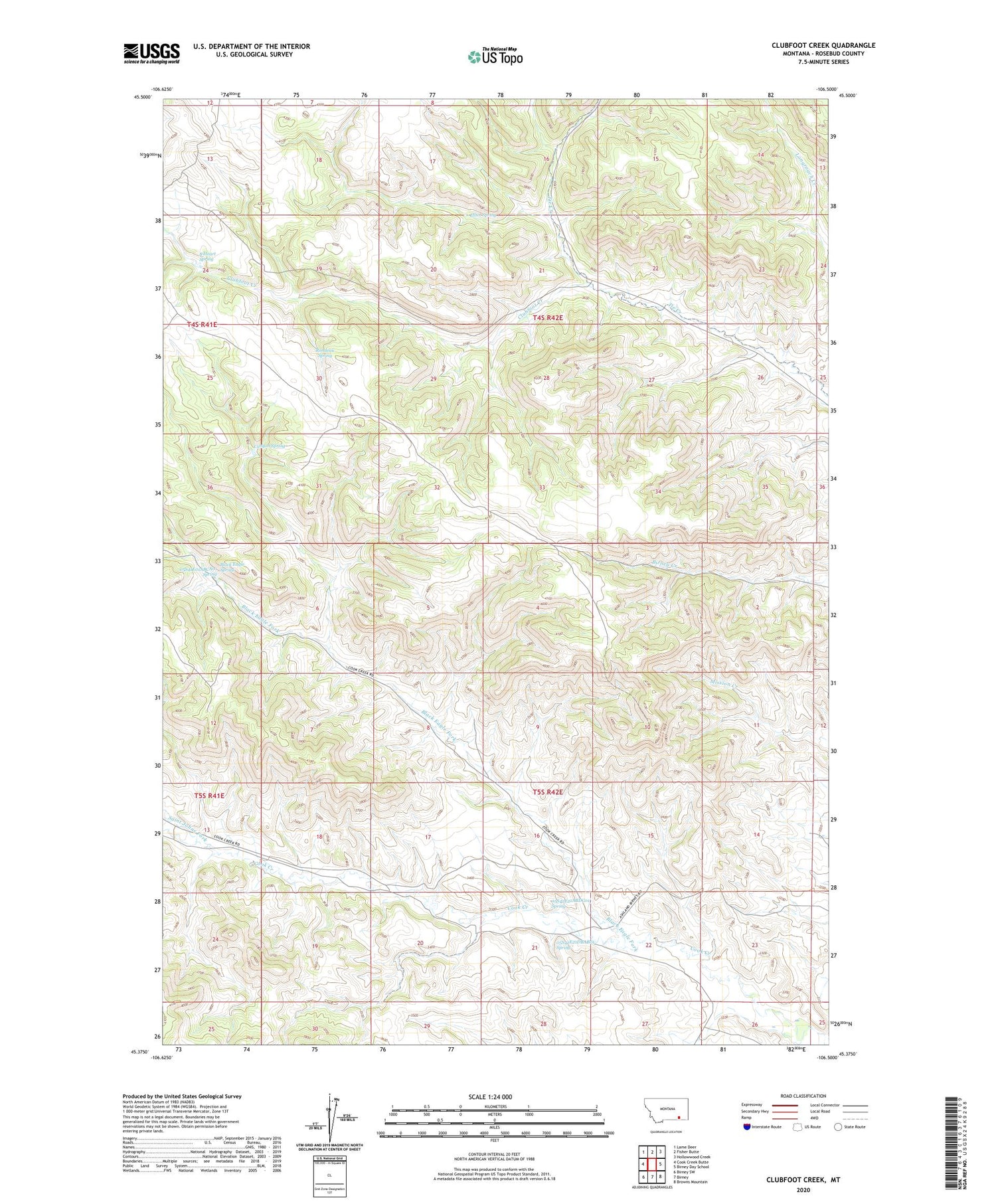
Clubfoot Creek Montana US Topo Map
Couldn't load pickup availability
2020 topographic map quadrangle Clubfoot Creek in the state of Montana. Scale: 1:24000. Based on the newly updated USGS 7.5' US Topo map series, this map is in the following counties: Rosebud. The map contains contour data, water features, and other items you are used to seeing on USGS maps, but also has updated roads and other features. This is the next generation of topographic maps. Printed on high-quality waterproof paper with UV fade-resistant inks.
Quads adjacent to this one:
West: Cook Creek Butte
Northwest: Lame Deer
North: Fisher Butte
Northeast: Hollowwood Creek
East: Birney Day School
Southeast: Browns Mountain
South: Birney
Southwest: Birney SW
Contains the following named places: 04S42E26BDA_01 Well, 05S41E01ABCA01 Spring, 05S41E13BCDA01 Well, 05S42E02AADD01 Well, 05S42E14ADDC01 Well, 05S42E16DDBD01 Well, 05S42E17CDCC01 Well, 05S42E18DCDB01 Well, 05S42E19BABD01 Well, 05S42E20ADAC01 Well, 05S42E20ADDB01 Well, 05S42E21ABDC01 Spring, 05S42E21DBAB01 Spring, 05S42E22BCBD01 Well, 05S42E22DBBC01 Well, B Heart Spring, Birney District, Black Eagle Fork, Black Eagle Spring, Canyon Spring, Cheyenne Number 4 Dam, Clubfoot Creek, Elliot Spring, Morland Ranch, Rondeau Spring, Saint Johns Fork