MyTopo
Coffee Creek Montana US Topo Map
Couldn't load pickup availability
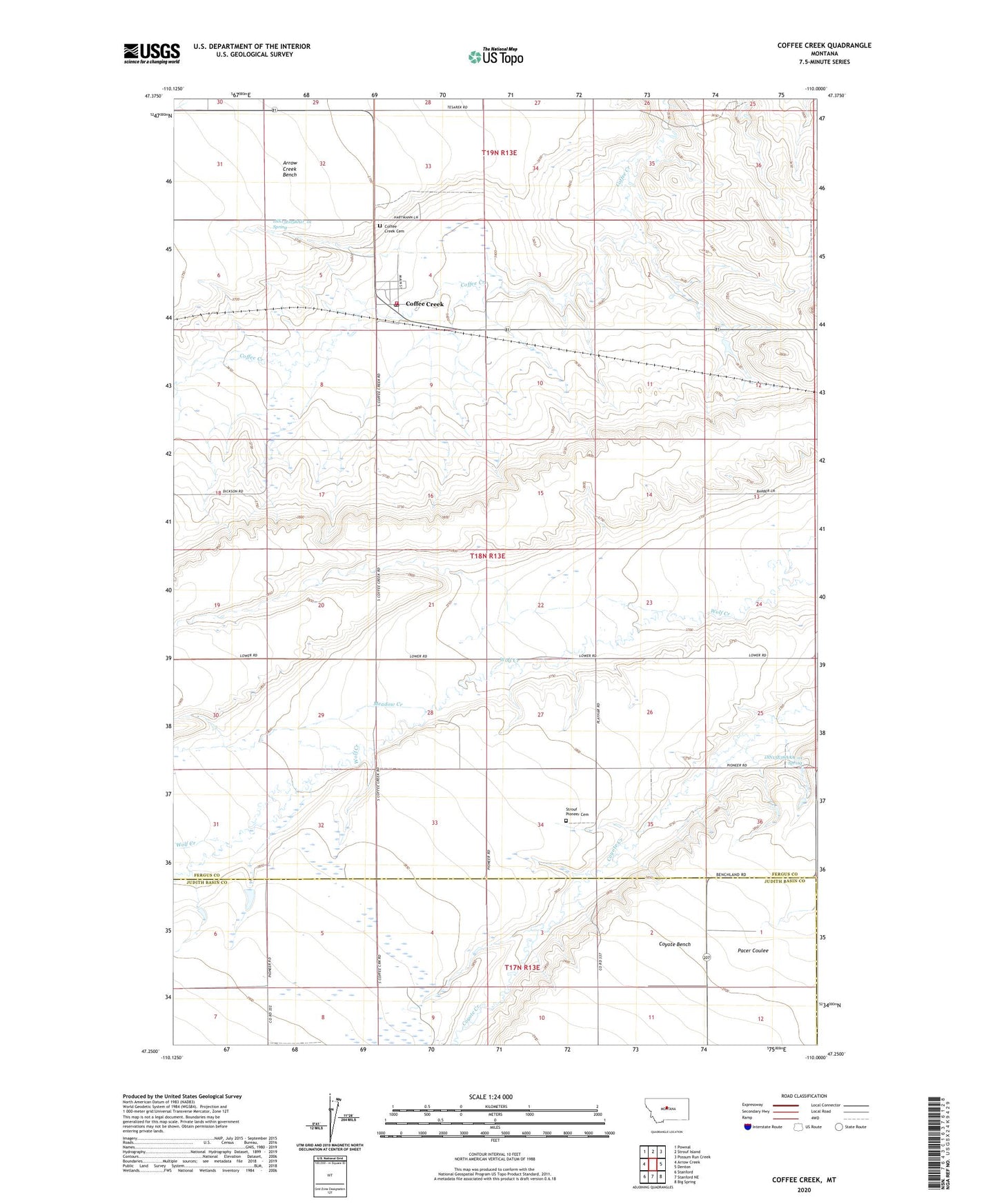
2024 topographic map quadrangle Coffee Creek in the state of Montana. Scale: 1:24000. Based on the newly updated USGS 7.5' US Topo map series, this map is in the following counties: Fergus, Judith Basin. The map contains contour data, water features, and other items you are used to seeing on USGS maps, but also has updated roads and other features. This is the next generation of topographic maps. Printed on high-quality waterproof paper with UV fade-resistant inks.
Quads adjacent to this one:
West: Arrow Creek
Northwest: Pownal
North: Strouf Island
Northeast: Possum Run Creek
East: Denton
Southeast: Big Spring
South: Stanford NE
Southwest: Stanford
This map covers the same area as the classic USGS quad with code o47110c1.
Contains the following named places: 17N13E06AA__01 Well, 18N13E05BAD_01 Spring, 18N13E05BDA_01 Well, 18N13E36AAA_01 Spring, 59424, Coffee Creek, Coffee Creek Cemetery, Coffee Creek Census Designated Place, Coffee Creek Church, Coffee Creek Post Office, Coffee Creek Rural Fire District, Haker School, Meadow Creek, Missouri Wolf Dam, Smart School, Strouf Pioneer Cemetery