MyTopo
Pownal Montana US Topo Map
Couldn't load pickup availability
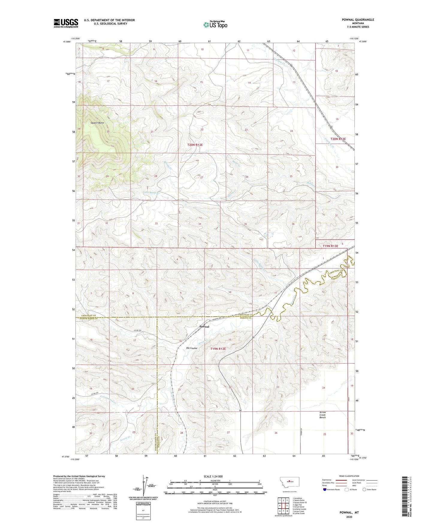
2024 topographic map quadrangle Pownal in the state of Montana. Scale: 1:24000. Based on the newly updated USGS 7.5' US Topo map series, this map is in the following counties: Chouteau, Fergus, Judith Basin. The map contains contour data, water features, and other items you are used to seeing on USGS maps, but also has updated roads and other features. This is the next generation of topographic maps. Printed on high-quality waterproof paper with UV fade-resistant inks.
Quads adjacent to this one:
West: Jiggs Flat
Northwest: Geraldine
North: Square Butte
Northeast: Square Butte SE
East: Strouf Island
Southeast: Coffee Creek
South: Arrow Creek
Southwest: Leiberg Coulee
This map covers the same area as the classic USGS quad with code o47110d2.
Contains the following named places: 19N12E14DBA_01 Well, 19N12E28DCD_01 Well, 20N12E10CCCA01 Well, 20N12E13BCDB01 Well, 20N12E14BBD_01 Well, 20N12E24CCC_01 Well, 20N12E24DDD_01 Well, 20N13E18CDCB01 Well, Cottonwood Creek, Davis Creek, Little Battle Creek, Ole Coulee, Pownal, Spring Creek, Square Butte, Surprise Creek