MyTopo
Como Peaks Montana US Topo Map
Couldn't load pickup availability
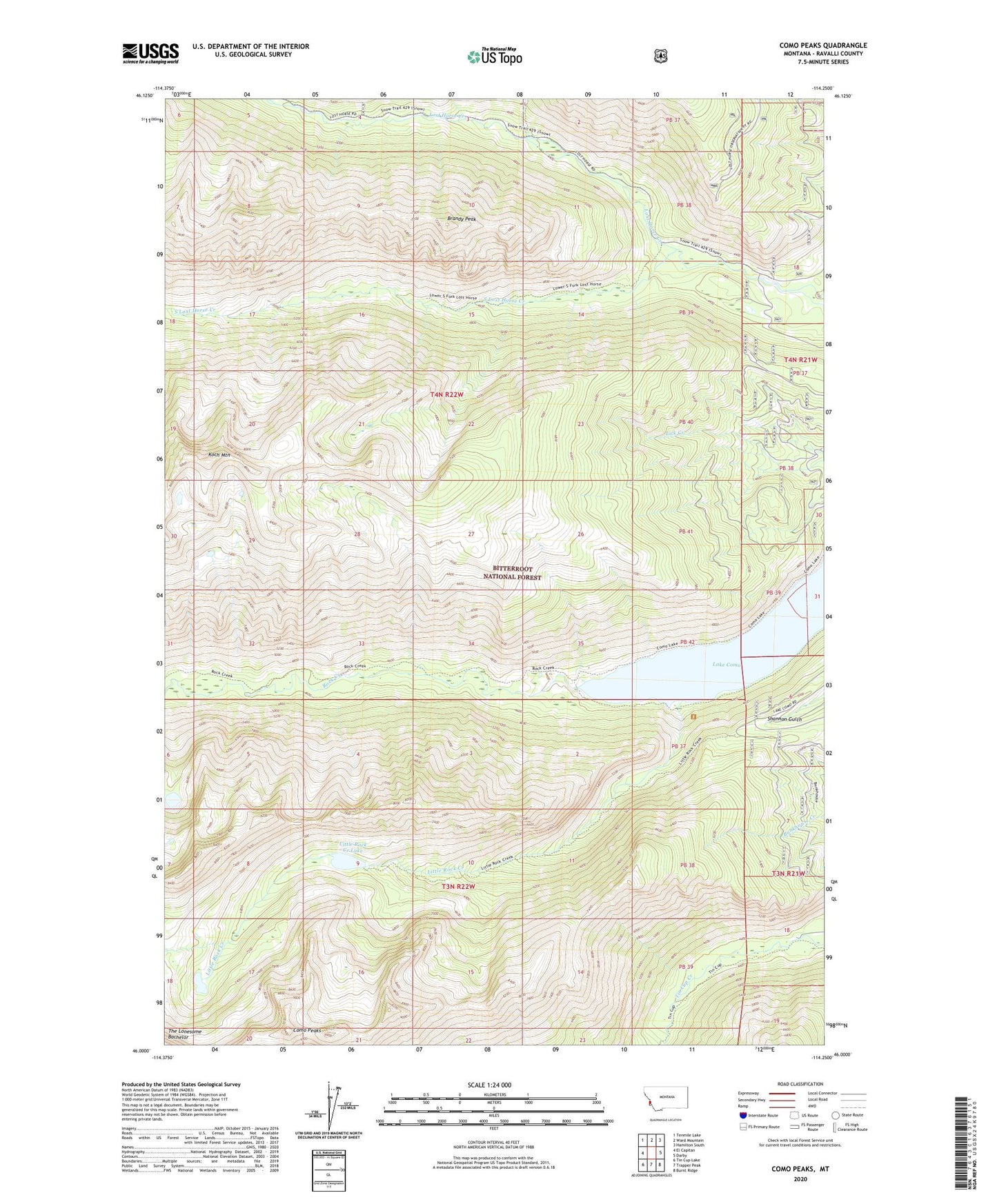
2020 topographic map quadrangle Como Peaks in the state of Montana. Scale: 1:24000. Based on the newly updated USGS 7.5' US Topo map series, this map is in the following counties: Ravalli. The map contains contour data, water features, and other items you are used to seeing on USGS maps, but also has updated roads and other features. This is the next generation of topographic maps. Printed on high-quality waterproof paper with UV fade-resistant inks.
Quads adjacent to this one:
West: El Capitan
Northwest: Tenmile Lake
North: Ward Mountain
Northeast: Hamilton South
East: Darby
Southeast: Burnt Ridge
South: Trapper Peak
Southwest: Tin Cup Lake
Contains the following named places: Brandy Peak, Como Peaks, Koch Mountain, Lake Como, Little Rock Creek, Little Rock Creek Lake, Lost Horse Observation Point, Lost Horse Trailhead, North Lost Horse Creek, South Lost Horse Creek