MyTopo
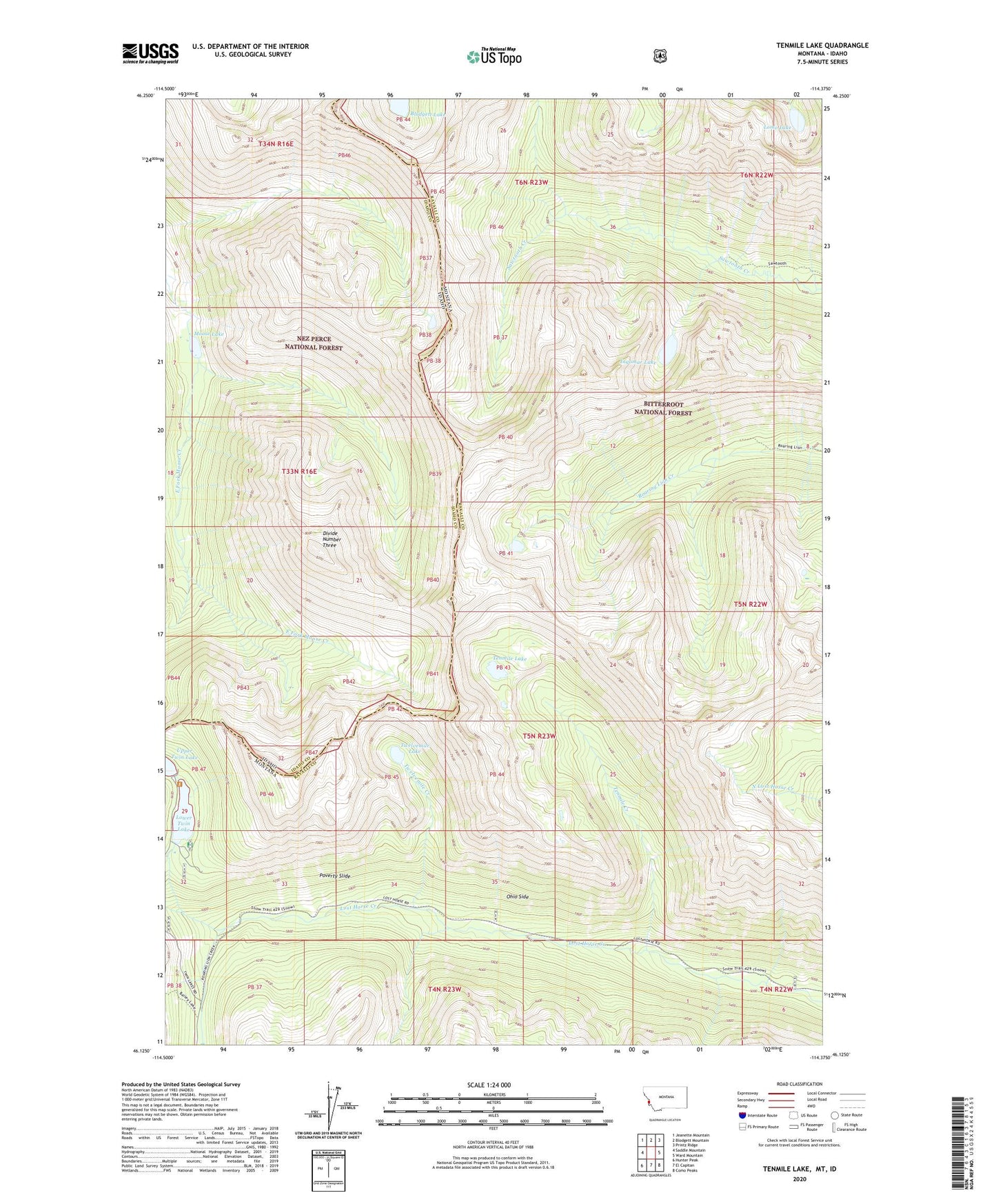
Tenmile Lake Montana US Topo Map
Couldn't load pickup availability
Also explore the Tenmile Lake Forest Service Topo of this same quad for updated USFS data
2024 topographic map quadrangle Tenmile Lake in the states of Montana, Idaho. Scale: 1:24000. Based on the newly updated USGS 7.5' US Topo map series, this map is in the following counties: Ravalli, Idaho. The map contains contour data, water features, and other items you are used to seeing on USGS maps, but also has updated roads and other features. This is the next generation of topographic maps. Printed on high-quality waterproof paper with UV fade-resistant inks.
Quads adjacent to this one:
West: Saddle Mountain
Northwest: Jeanette Mountain
North: Blodgett Mountain
Northeast: Printz Ridge
East: Ward Mountain
Southeast: Como Peaks
South: El Capitan
Southwest: Hunter Peak
This map covers the same area as the classic USGS quad with code o46114b4.
Contains the following named places: Blodgett Lake, Divide Number Three, Ingomar Lake, Lomo Lake, Lost Horse Guard Station, Lower Twin Lake, Lower Twin Lakes Dam, Moose Lake, Ohio Side, Poverty Slide, Schumaker Campground, Tenmile Creek, Tenmile Lake, Twelvemile Creek, Twelvemile Lake, Twin Lakes, Upper Twin Lakes Dam