MyTopo
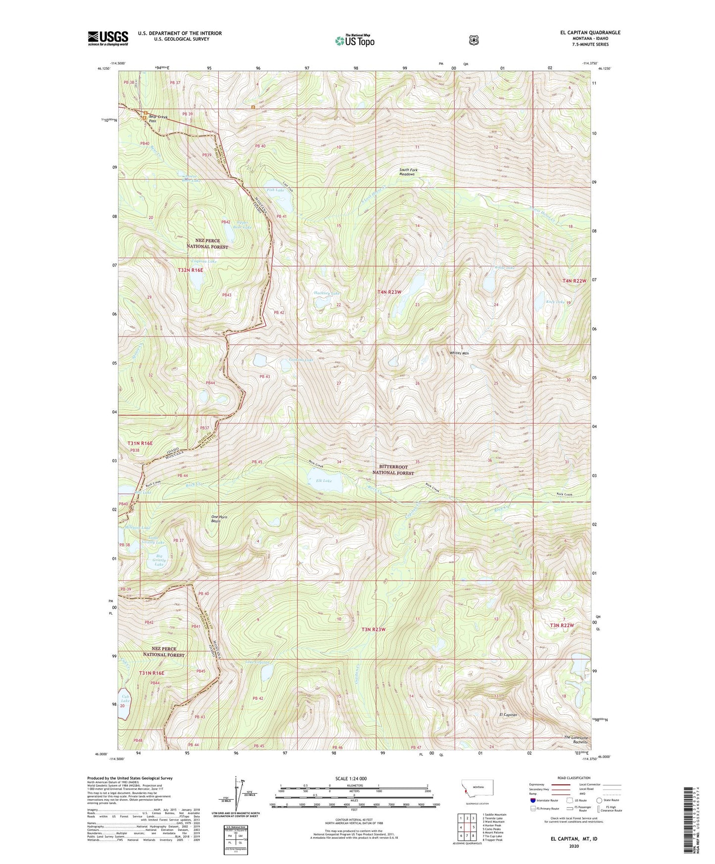
El Capitan Montana US Topo Map
Couldn't load pickup availability
Also explore the El Capitan Forest Service Topo of this same quad for updated USFS data
2024 topographic map quadrangle El Capitan in the states of Montana, Idaho. Scale: 1:24000. Based on the newly updated USGS 7.5' US Topo map series, this map is in the following counties: Ravalli, Idaho. The map contains contour data, water features, and other items you are used to seeing on USGS maps, but also has updated roads and other features. This is the next generation of topographic maps. Printed on high-quality waterproof paper with UV fade-resistant inks.
Quads adjacent to this one:
West: Hunter Peak
Northwest: Saddle Mountain
North: Tenmile Lake
Northeast: Ward Mountain
East: Como Peaks
Southeast: Trapper Peak
South: Tin Cup Lake
Southwest: Mount Paloma
This map covers the same area as the classic USGS quad with code o46114a4.
Contains the following named places: Bear Creek Pass, Bear Creek Pass Campground, Bell Lake, Big Grizzly Lake, Capitan Creek, Coquina Lake, Cub Lake, El Capitan, Elk Lake, Fish Lake, Fish Lake Dam, Hackney Lake, Kock Lake, Lake Capitan, Little Grizzly Lake, Lookout Lake, Lost Horse Lake, Lower Bear Lake, Milepost Lake, One Horn Basin, South Fork Meadows, Upper Bear Lake, White Lake, Whites Mountain