MyTopo
Connor Creek Montana US Topo Map
Couldn't load pickup availability
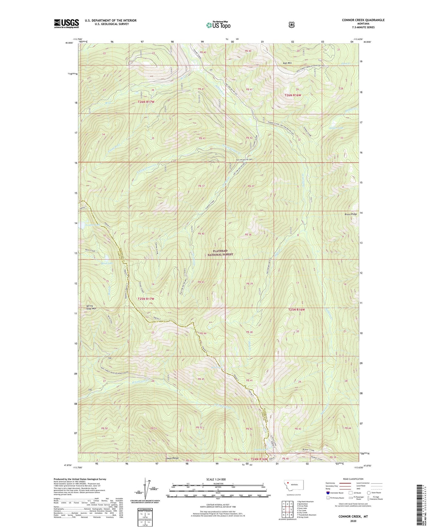
2020 topographic map quadrangle Connor Creek in the state of Montana. Scale: 1:24000. Based on the newly updated USGS 7.5' US Topo map series, this map is in the following counties: Flathead, Lake. The map contains contour data, water features, and other items you are used to seeing on USGS maps, but also has updated roads and other features. This is the next generation of topographic maps. Printed on high-quality waterproof paper with UV fade-resistant inks.
Quads adjacent to this one:
West: Swan Lake
Northwest: Big Hawk Mountain
North: Quintonkon
Northeast: Circus Peak
East: Tin Creek
Southeast: String Creek
South: Thunderbolt Mountain
Southwest: Cilly Creek
Contains the following named places: Bond Lake, Branch Creek, Connor Creek, Crevice Lake, Kah Lookout, North Fork Connor Creek, Rock Lake, Slide Creek, Soldier Lake, South Fork Branch Creek, Spring Slide Mountain, Trinkus Lake